
Romans Changed Europe's Landscapes Far Beyond the Road Network
A hill of broken amphorae, a frontier across Britain and gold mines in Spain reveal the lasting ways Romans changed the landscape.

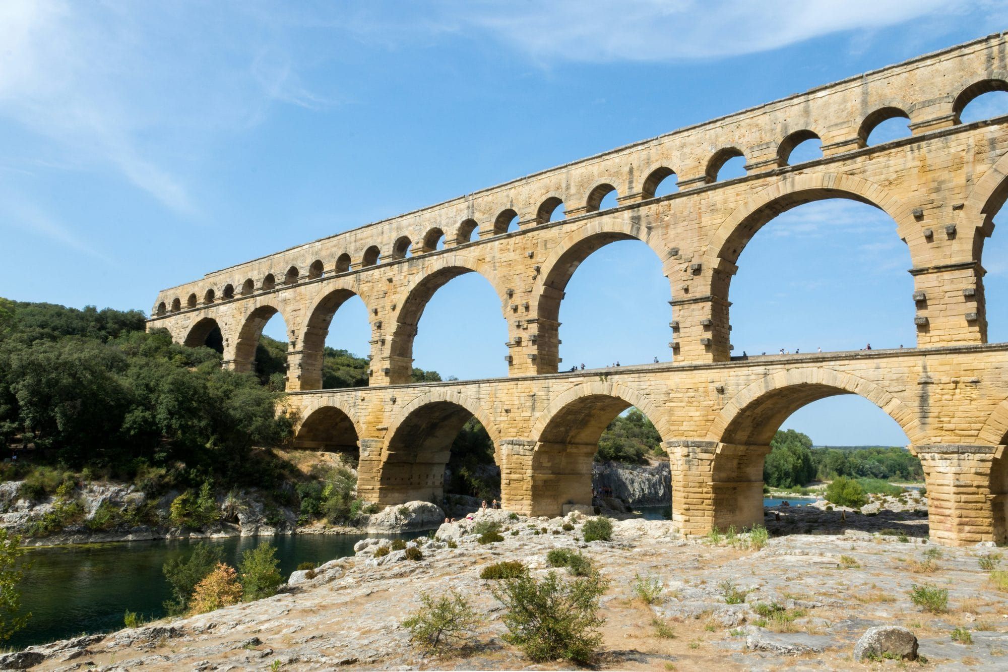
The Roman Empire changed the countryside through roads, water supplies, land division and the demands of its settlements. Some of those changes remain easy to recognise in a bridge or a paved route. Others emerge from much smaller evidence: pottery scattered across a field, pollen preserved in an excavated layer, or grape seeds recovered from an ancient well.
These traces reveal changes in where people lived, what they cultivated and how they obtained goods. A new road could strengthen a town's connections. A surveyed agricultural grid could accompany a different pattern of rural consumption. Soldiers stationed along a river created demand for supplies, while cities drew distant water into systems that supported new public buildings and private amenities.
Research in Roman Italy, Asia Minor and the northern frontier brings these processes into focus at different scales. The results show a countryside shaped by government decisions, local investment and daily work. They also show how much could vary between neighbouring settlements. Understanding Rome's impact means examining those differences alongside the large monuments that have become its most familiar features.
Rome's discarded amphorae became a hill
Monte Testaccio, beside Rome's ancient river-port district, turns the aftermath of trade into topography. The artificial hill consists of discarded amphora fragments accumulated near the warehouses that received the capital's supplies. Most excavated vessels are Dressel 20 amphorae, associated with olive oil from Baetica in southern Spain. Containers arriving through Mediterranean commerce became a lasting addition to the city's ground.
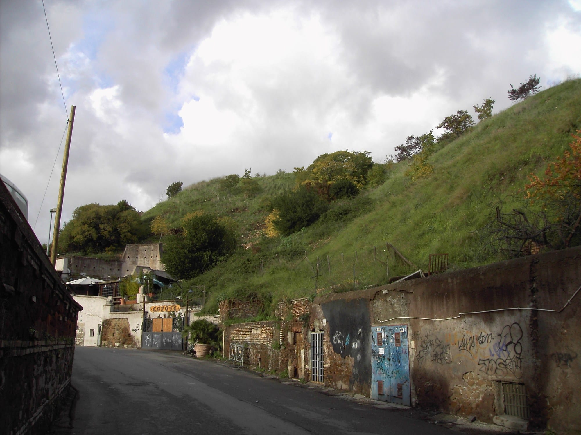
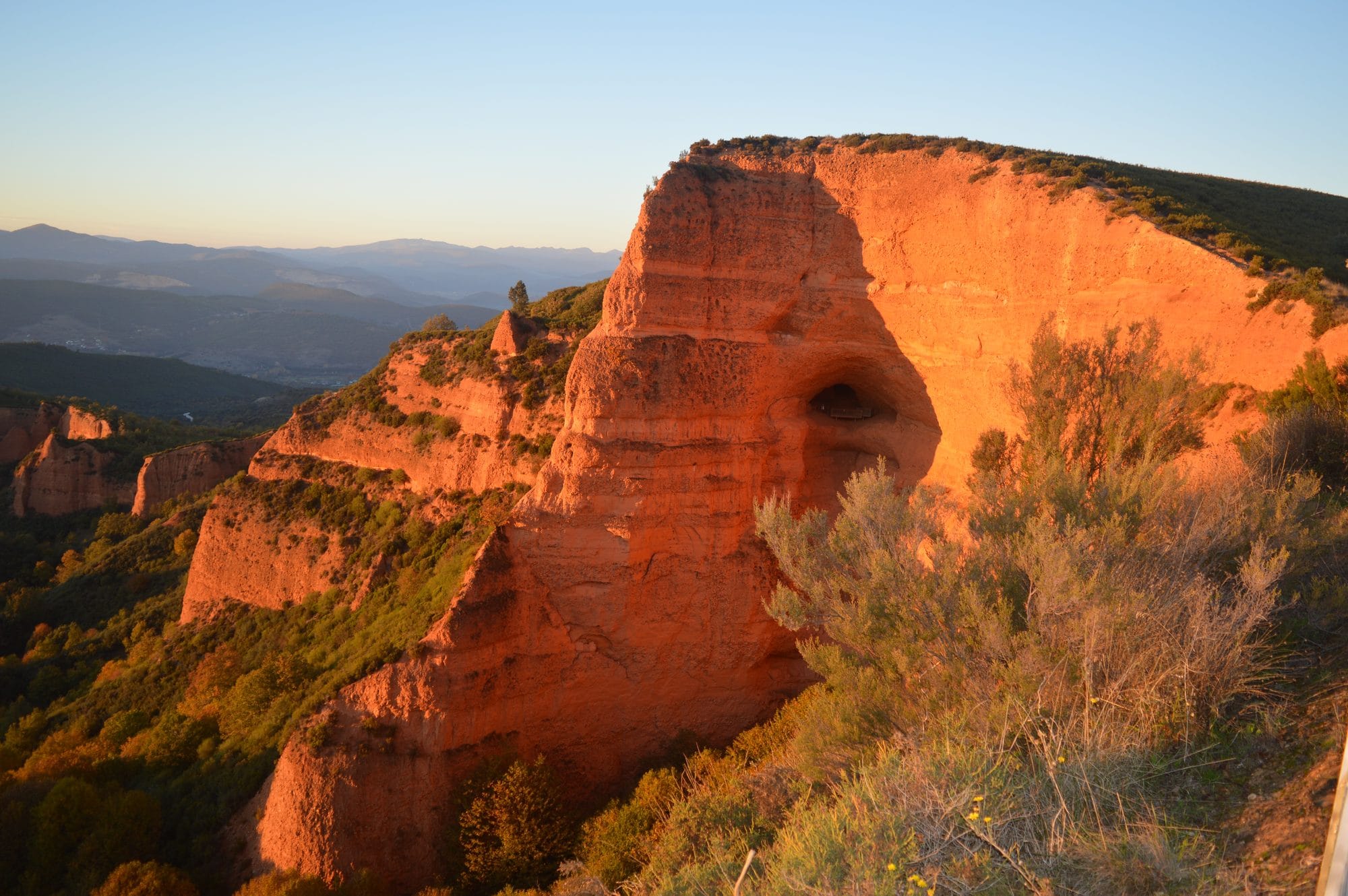
The mound grew through organised deposition. Archaeological reconstruction identifies terraces built from systematically arranged pottery, rather than a heap tipped without structure. Its successive layers preserve the material consequences of repeated deliveries and disposal. Our account of the amphorae that formed Monte Testaccio follows the containers and the inscriptions through which this unusual hill can be investigated.
Those fragments also connect the altered landscape to identifiable trading activity. A study analysed 7,520 amphora stamps from ten excavations conducted between 1990 and 2014, covering material dated to 143–260 CE. Repeated stamped codes allowed comparisons between participants in the olive-oil trade. The hill therefore preserves both the physical accumulation of packaging and evidence for the economic networks that supplied Rome.
Gold mining remade the ground at Las Médulas
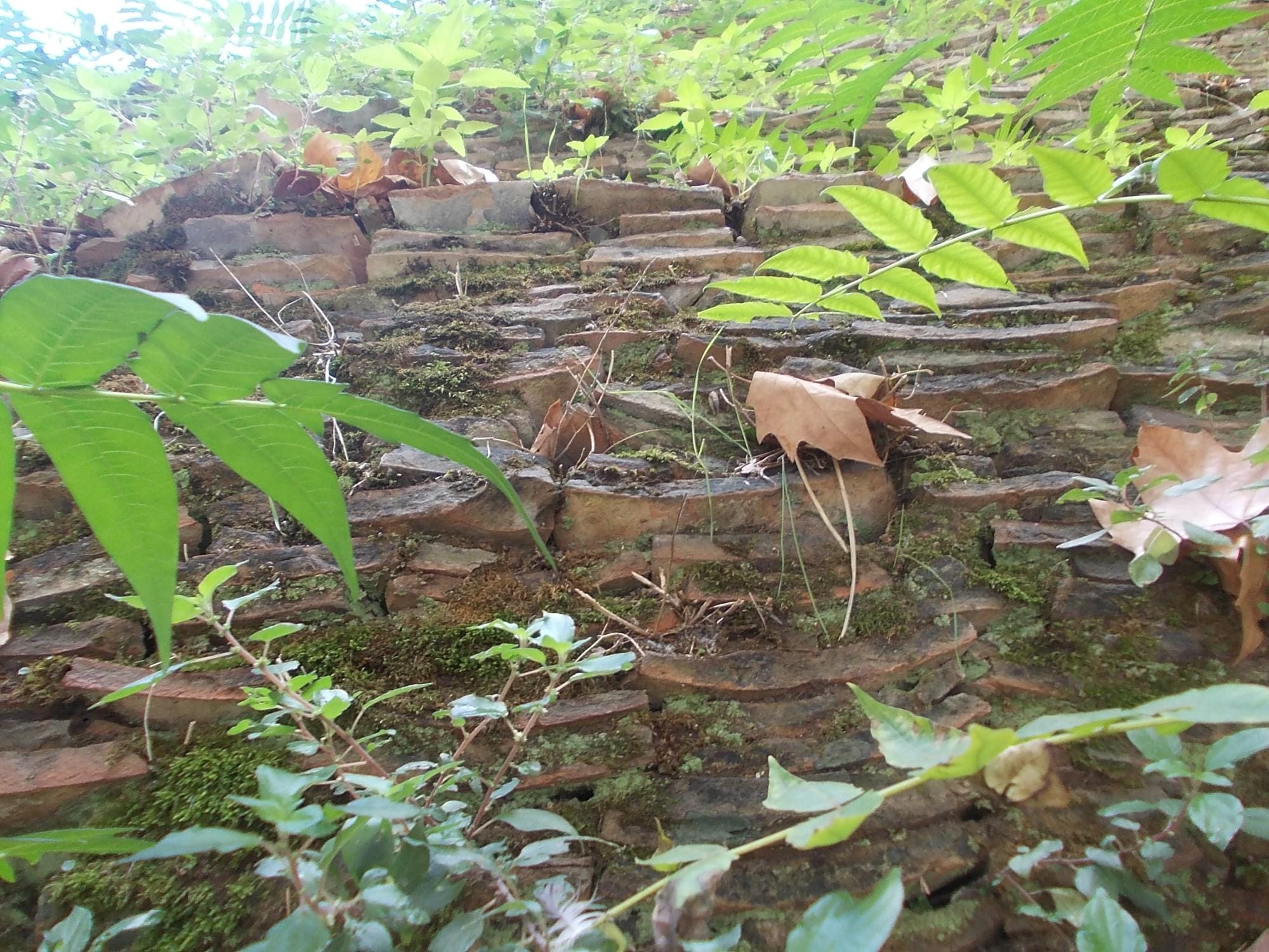
At Las Médulas, in León in north-western Spain, Roman gold extraction left steep red faces and isolated pinnacles in the former ore-bearing deposits. Mining during the first and second centuries CE dismantled substantial parts of that ground. Archaeological research treats the workings together with their water supply, waste deposits and settlements as a connected landscape shaped by the exploitation of provincial resources.
Water made this transformation possible. Channels carried it towards the workings, where hydraulic power supported the extraction and washing of gold-bearing material. Construction and maintenance of the supply network required small settlements adapted to the terrain along its routes. The excavation and displacement were enormous: the research team estimated that almost 100 million cubic metres (131 million cubic yards) of earth had been moved.
The displaced material transformed the lower ground too. Research recorded mining waste filling former valleys and hollows, creating new surfaces later used for cultivation. The largest accumulation, Chaos de Maseiros, blocked a valley and brought Lake Carucedo into being unintentionally. The surviving landscape records excavation and deposition together: ground removed from the mine became the material that reshaped the terrain below.
Survey lines changed life on the farm
Near Empoli, in northern Etruria, archaeologists have identified traces of centuriatio, the division of land into a surveyed grid. The arrangement probably belongs to the establishment of colonies in the second half of the first century BCE. Research in the valleys of the Orme and Pesa, tributaries of the Arno, has compared settlements in and around this divided countryside through fieldwalking, geophysical investigation and excavation.
Two rural sites offer a particularly useful comparison. Molino San Vincenzo lay outside the grid; Il Cotone lay within it, or at its edge. Pottery indicates agricultural activity at Molino San Vincenzo between the fourth and second centuries BCE, while most of the material at Il Cotone belongs to the imperial period. Both places combined residence and agricultural activity, but their inhabitants used markedly different collections of vessels.
Il Cotone produced a greater proportion of tableware and imported pottery, including Italian fine wares and African cooking and dining vessels. Molino San Vincenzo had more large storage jars and relied more heavily on local or regional products. The published interpretation connects this contrast tentatively with the estates' ownership and their relationship to the surveyed land. Easier access to navigable waterways at Molino San Vincenzo makes transport cost alone an unsatisfactory explanation. Land organisation may therefore have affected household consumption as well as the arrangement of fields.
Pollen reveals a different Tuscany
At Molino San Vincenzo, pollen extracted directly from Roman archaeological layers points to a mixture of cereal cultivation and grassland. The evidence includes barley, the oat-wheat group and rye, together with plants associated with pasture. This was an agricultural setting in which growing crops and keeping animals both contributed to the local economy. These excavated remains document the crops and pasture associated with the Roman farm beneath the modern agricultural landscape.
Legumes, clovers and grasses also suggest the cultivation of fodder. The combination has been interpreted as evidence for convertible husbandry: an agricultural system in which land alternated between crops and pasture. Such practices linked animal keeping with the management of cultivated soil. The interpretation draws on the plant assemblage as a whole, allowing researchers to investigate the organisation of farming beyond the buildings that happened to survive.
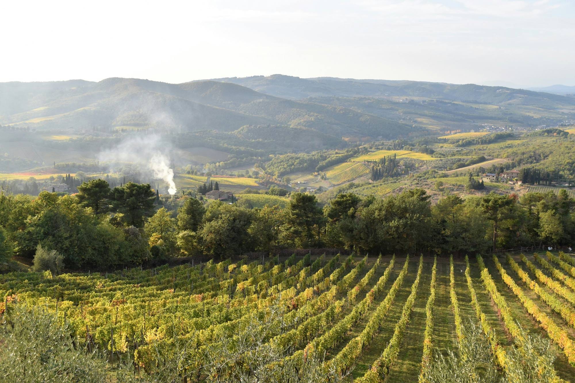
The Roman pollen samples contained no indicators of vines or olives growing near this particular site. Today, vineyards and olive groves are prominent in the surrounding landscape. The contrast gives a local answer to the assumption that the Tuscan countryside has always looked much as it does now. Nearby places had their own histories of cultivation, and research elsewhere in the region provides a different view of how Roman influence affected vineyard work.
Grape seeds track a change in vineyard work
At Cetamura in Chianti, a rock-cut well preserved waterlogged botanical remains in unusually good condition. Excavation between 2011 and 2014 recovered grape pips from dated deposits spanning several Etruscan and Roman phases. A study of 454 recovered pips combined measurements of intact seeds with genetic analysis of a smaller sample. The well, approximately 33 metres (108 feet) deep, provided evidence for changes in cultivation across several centuries.
The older group of pips, from the third century BCE, was generally smaller than those belonging to later phases. A marked increase appeared around 200 BCE. Combining the physical measurements with the available genetic results, the researchers proposed a change in vineyard management rather than the introduction of new varieties. More regular pruning was one suggested explanation, because changes in the number of buds and bunches can affect the growth of grapes and their seeds.
The change appeared while Cetamura retained an Etruscan cultural setting under growing Roman influence. The study also places it alongside changes in wine containers and wider investment in production and trade. The vineyard and cellar practices of Roman winemaking depended on accumulated skills and repeated work. Changes in training, pruning and the arrangement of vines could alter the appearance of cultivated hillsides as well as the labour needed to maintain them.
Roads reorganised the places they connected
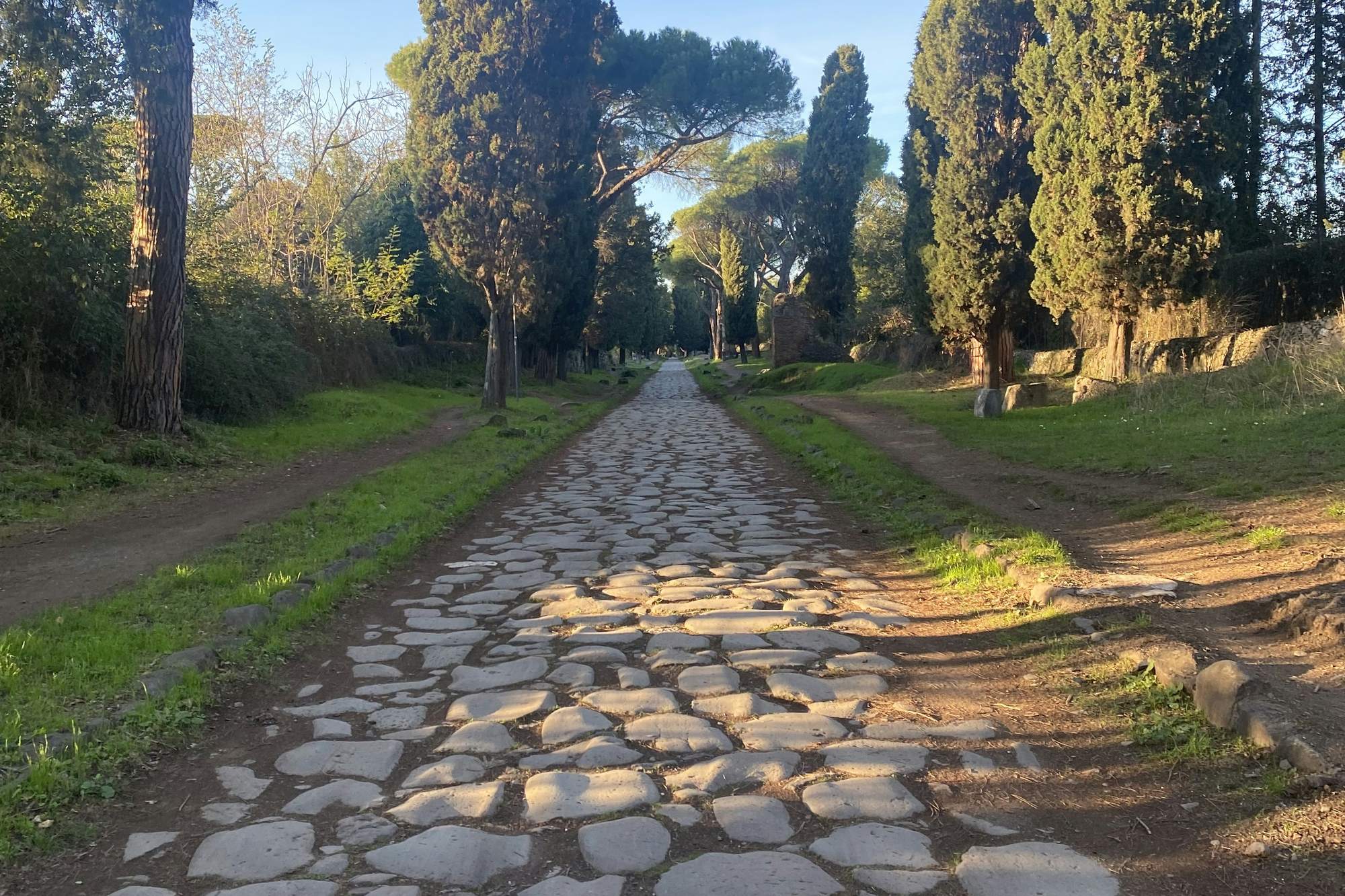
Roman roads changed landscapes during construction and continued to influence them afterwards. Cuttings, embankments and bridges carried routes across difficult ground, while the finished roads became reference points for boundaries and later development. In Republican Italy, road building could be closely connected with land distribution. The Via Flaminia, built in 220 BCE, was associated with the settlement of land in the ager Gallicus et Picenus.
Routes also changed the relative importance of the settlements they reached. Dertona, modern Tortona, grew after the Via Postumia passed through the existing Ligurian settlement. Its later establishment as a Roman colony and connection with another major route reinforced that position. Roads often followed earlier paths, bringing inherited patterns of movement into new political and administrative arrangements. The relationship between Roman road alignments and terrain was therefore one part of a much wider transformation.
Milestones made this connected territory legible to travellers. Their distance figures identified important destinations, while the names of magistrates recorded Roman authority along the route. Roads also required continuing maintenance, expenditure and legal responsibilities. Their effect extended through the towns and communities they crossed as officials and local inhabitants kept them usable. A route's political presence was renewed through these practical obligations, as well as through the inscriptions standing beside it.
Aqueducts depended on the cities around them
In Roman Asia Minor, the expansion of long-distance water supplies brought more water into cities for drinking, bathing, fountains and other facilities. Much of the necessary hydraulic knowledge had developed in the Hellenistic period. Under Roman rule, cities invested extensively in aqueducts and the urban amenities they supplied. Research on the region emphasises the role of civic resources and local decisions in this expansion, alongside assistance from emperors and governors.
Aphrodisias provides an example of the negotiations involved. Correspondence with Hadrian concerned the financing of an aqueduct, including the use of funds associated with high priests and gladiatorial spectacles. The emperor approved the proposed financial arrangements and offered administrative support. At Patara, an inscription recording repairs after earthquake damage describes contributions from existing revenues and the Lycian League. These cases show how water infrastructure depended on the organisation of money as well as engineering.
Municipal authorities also had to balance the capacity of their supply with demands from public buildings and private users. A new bath or fountain became part of a connected system whose flows needed regulation. The construction and operation of Roman aqueducts altered both the route from the water source and the city receiving it. In Asia Minor, the resulting infrastructure also became an expression of civic identity, as communities took pride in the quality and abundance of their water.
Hadrian's Wall cut a frontier into existing farmland
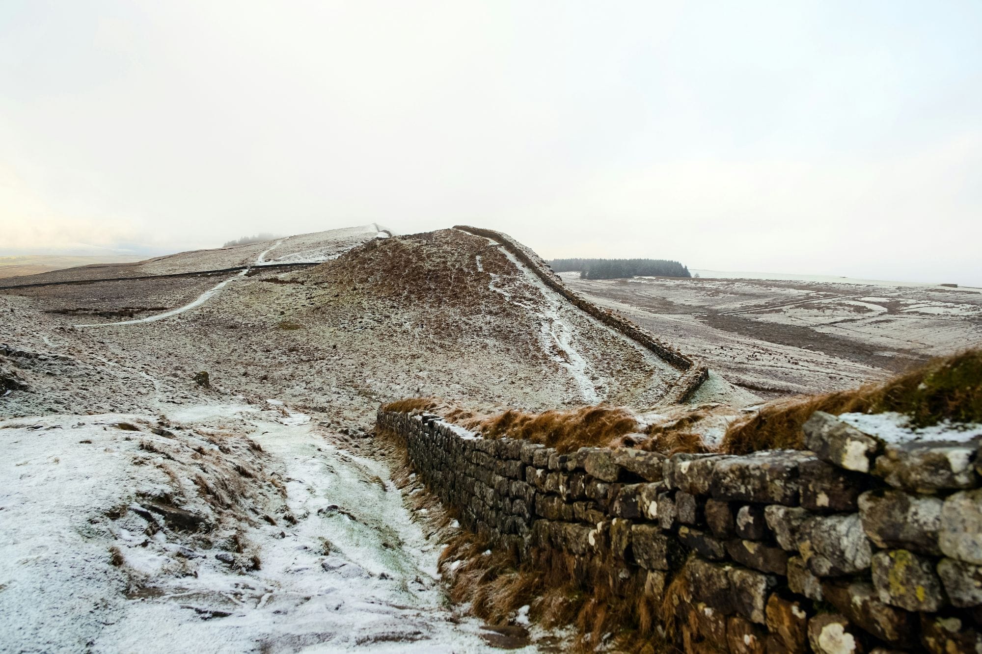
In northern Britain, the frontier system of Hadrian's Wall transformed a broad strip of countryside through construction in stone, turf and earth. Its physical imprint includes the northern ditch, forts, towers and the Military Way, as well as the wall itself. South of the curtain ran the Vallum, a separate complex of earthworks that made the military landscape wider than the surviving masonry suggests.
The Vallum's central ditch was nominally approximately 6 metres (20 feet) wide and 3 metres (10 feet) deep, with actual profiles varying between excavated locations. Mounds flanked it, while gated causeways provided crossings at forts. In the central sector, the wall followed the crags of the Whin Sill and the Vallum ran through the valley below. The frontier's components followed different lines within the same terrain.
Excavation also exposes the countryside beneath the engineering. At Black Carts, the Vallum covered ploughed land crossed shortly beforehand by hoofed animals. Builders raised the bank north of the wall's ditch where hard rock limited its depth. These buried surfaces and adjustments show a frontier imposed on worked land and adapted to local geology, linking the monumental remains to the fields and practical decisions involved in their construction.
Army camps created uneven rural economies
Along the northern frontier, permanent military populations created a sustained need for food and other supplies. Goods reached soldiers through taxation in kind, purchases, contracts and wider trading connections. The countryside around a fort was consequently part of a supply system extending beyond the camp itself. Researchers have investigated how this demand affected rural settlement by comparing sites in the Lower Rhine region of the Netherlands and the Lower Danubian plain in Bulgaria.
The analysis examined the landscape around settlements and their relationship to potential markets. In the Lower Rhine study area, communities consistently favoured natural river levees and avoided more marginal ground. Their preference for particular levees strengthened during the earliest phase of Roman rule, suggesting a greater emphasis on land suitable for cultivation. In the Lower Danube area, gently sloping hills became more attractive at different times on either side of the Yantra River.
The role of auxiliary forts as local marketplaces varied with period and location. Some settlement patterns suggest that particular forts attracted rural producers; elsewhere civilian centres provided the stronger connection. The Danubian market results were less statistically secure than those from the Rhine. Across the study, the agricultural potential of the ground remained essential to explaining where people lived. Military demand influenced an existing rural world whose soils, rivers and settlement histories continued to shape the available choices.
The same ground could serve a different purpose
In the Lower Danube study, the most marked change came in late antiquity. During the fifth and sixth centuries CE, particularly in the eastern zone, settlement locations favoured access to valleys, ridges and steep ground. Deeply cut river valleys created promontories with cliffs that offered opportunities for refuge. The interpretation links this shift to insecurity: proximity to defensible places became a stronger consideration than the agricultural advantages that had previously attracted settlement.
Other changes were visible within households. At Molino San Vincenzo, elaborate tablewares were relatively more common in an earlier phase, while simpler local and regional wares became dominant from the second century BCE. A neighbouring settlement showed an increase in the quality of its material culture during the same broad period. Even within one small area, integration into Roman Italy produced different patterns of consumption and participation in exchange.
Together, the case studies show how Roman landscapes were shaped through the interaction of public infrastructure, property arrangements, cultivation and local priorities. Survey grids and roads could accompany new connections, while existing communities changed how they used fields and obtained goods. Later insecurity could redirect settlement towards places offering protection. The continuing research question is how these processes combined in individual regions, where the evidence increasingly allows the histories of farms and villages to be examined alongside those of roads, cities and imperial government.




About the Roman Empire Times
See all the latest news for the Roman Empire, ancient Roman historical facts, anecdotes from Roman Times and stories from the Empire at romanempiretimes.com. Contact our newsroom to report an update or send your story, photos and videos. Follow RET on Google News, Flipboard and subscribe here to our daily email.
Follow the Roman Empire Times on social media: