
Roman Road and Possible Parade-Ground Wall Found at a Welsh School
A seven-metre Roman road, a possible parade-ground wall and a culvert have emerged during building work at Caerleon Comprehensive School.

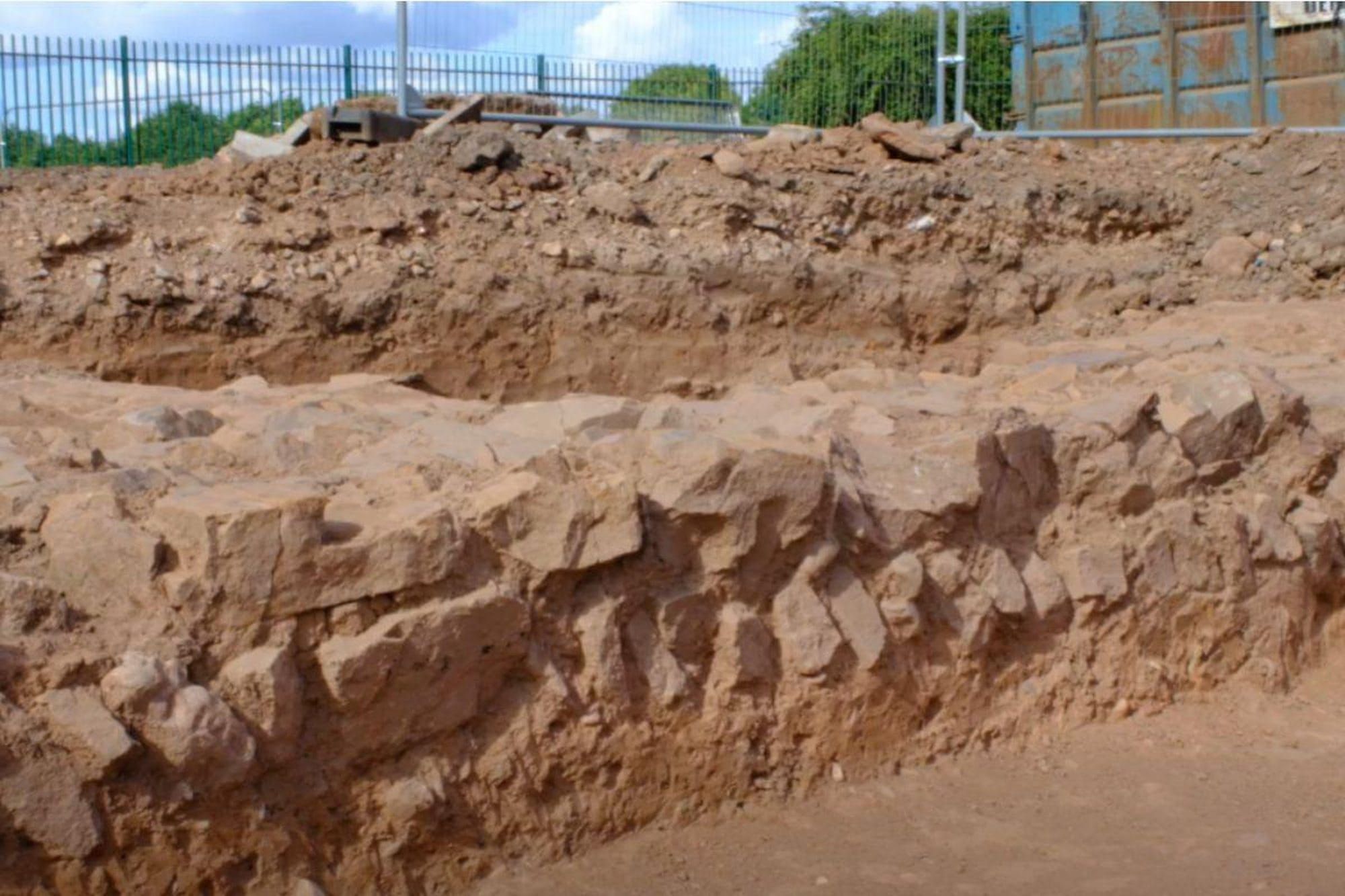
Archaeologists working at Caerleon Comprehensive School in south Wales have uncovered a Roman road about seven metres wide, stonework thought to belong to a parade-ground wall and a well-built drain or culvert. The remains emerged during building work at a school close to the fortress of Isca, home of the Second Augustan Legion.
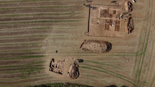
Heneb, the Trust for Welsh Archaeology, began by monitoring construction but expanded the work into a full excavation as stone deposits appeared. The discoveries were reported in September 2026 while Newport City Council was developing new sports and teaching facilities at the school. The excavation is recording features that survived beneath a working campus.
The site already had a Roman signal. A 2012 evaluation found pottery in a deposit interpreted as a likely occupation layer, although the trenches examined then did not encounter Roman structures. The new exposure places visible masonry and a road beside that earlier evidence and adds detail to the landscape around one of Roman Britain's major military bases.
From a watching brief to an excavation
The building project includes a sports hall, improved changing facilities and new teaching space. Archaeological monitoring was built into the work because the school occupies ground near Caerleon's known Roman remains. A watching brief allows archaeologists to inspect ground as construction opens it; at this site, the appearance of substantial stone deposits prompted a larger investigation.
Heneb's site supervisor, Martin Tuck, told the South Wales Argus that what began as monitoring had become a full excavation. The team has identified a broad road system and a substantial wall interpreted provisionally as part of a parade ground. A drain or culvert associated with the exposed remains adds another built feature to the picture.
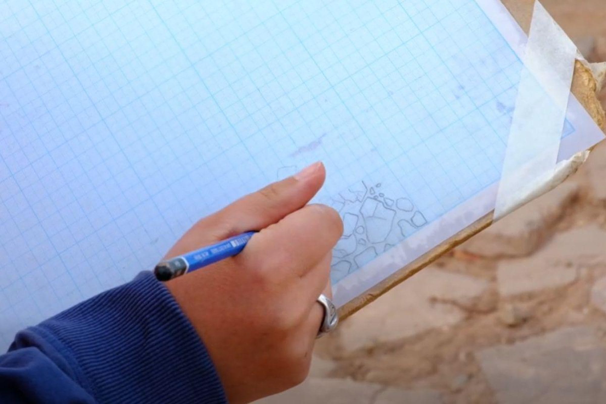
The archaeologists are recording the excavation through photographs, written descriptions, measured drawings and drone images. Those records preserve the position and relationship of the features as the project proceeds. At a built-up site, the arrangement of a road, wall and drainage feature can help researchers compare newly exposed ground with the remains documented nearby.
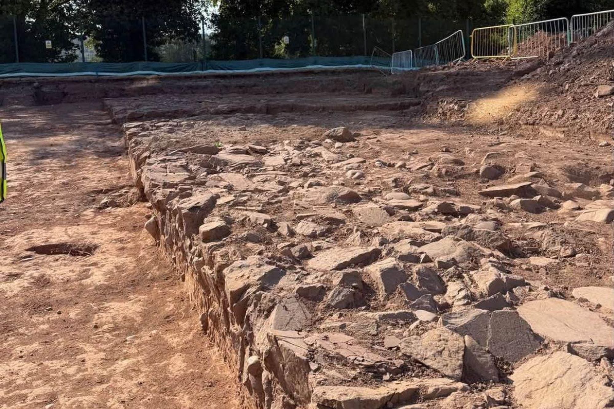
The road heading from Broadway
The road is reported to be approximately seven metres wide. Tuck said the discovery extends knowledge of a route known from the Broadway playing fields, heading toward or through the school. This makes the new work particularly useful for tracing how movement was organised outside the fortress, where modern buildings and playing fields divide the surviving evidence.
Broadway lies near the south-western side of the Roman fortress. Earlier investigations identified a level area there that has been interpreted as a parade ground. The Royal Commission's record describes a gravelled surface enclosed by a stone wall, drawing on mid-twentieth-century excavations.
The culvert gives the route a practical dimension. It was described by the excavators as a well-engineered drainage feature associated with the road and wall. Drainage and the ground beneath a road are part of the structure archaeologists need to document before judging how the route was made and used. Our account of Roman road construction and its local adaptations gives the wider engineering background.
Why the wall is being linked to a parade ground
The newly exposed wall has been described as a possible parade-ground boundary. That description is an interpretation of the masonry and its position, not a final published identification. The established Broadway evidence makes the suggestion plausible, while the excavation record will allow the new wall's line and construction to be compared with earlier plans.
At Broadway, a walled and gravelled open space has long been associated with military displays or training. Its relationship with the nearby amphitheatre has also been discussed in the Royal Commission's account. Its plan provides a point of comparison for the new wall’s alignment, construction and position beside the road.
The photographs and scale drawings made during the school excavation should help establish the wall's alignment and how it meets the road and culvert. Comparison with the Broadway plans can then test whether the new masonry continues a known boundary, or belongs to another part of the Roman layout. A measured comparison would place the new masonry within a more detailed plan of Caerleon’s Roman outskirts.
What the school site had already revealed
The 2025 planning statement for the school summarised an archaeological evaluation carried out in January 2012. That earlier work found no Roman structure in the areas it tested, but one deposit contained decorated samian pottery, fragments of a Caerleon ware flagon and pieces of colour-coated beakers. The statement described the deposit as a likely Roman occupation layer.
The pottery included material dated from the mid-first to the fourth century AD. That range describes the ceramics within the deposit; it does not date the newly uncovered road or wall. The earlier evaluation also identified a separate later levelling deposit containing eighteenth- and nineteenth-century pottery, evidence of the site's subsequent history.
The planning statement warned that construction at the level of the Roman deposit would need archaeological mitigation, despite assessing a low probability of further remains beneath previously built areas. It proposed careful work and hand excavation where needed so that finds could be recorded. The 2026 excavation shows why that provision was important at this particular school site.
A new window onto Isca
Caerleon was the legionary fortress of Isca, established in the later first century AD for Legio II Augusta. Its surviving amphitheatre, baths and barracks are the most familiar parts of the military site, but the Roman landscape extended beyond the fortress walls. Roads and open spaces connected the garrison with activity around it.
Academic surveys within the fortress have mapped an internal street grid, barracks and a large complex interpreted as a probable workshop. That research examined School Field, the sports field of Caerleon Endowed Schools inside the fortress. It is a different school site from the present excavation at Caerleon Comprehensive, and shows how much of Isca's plan has been built through separate investigations over time.
The new road belongs to that accumulating map of the fortress surroundings. Its position beside a possible parade ground gives this route a place within Caerleon’s military landscape. Our report on how Roman roads connected provincial centres offers the larger setting, while the Caerleon trench supplies the direct evidence for this stretch.
What the excavation can add
The discovery brings together three elements in one construction area: a broad road, substantial walling and a built drain. Their documented positions should help archaeologists compare the school site with the Broadway finds and decide how this piece of ground related to the fortress and its neighbouring open spaces.
The history around the garrison included people and activities beyond the soldiers inside its walls. Our account of everyday life in Roman Britain describes that wider setting; here, the present evidence is chiefly architectural. The road and wall show how this particular area was laid out, while finds from secure layers may eventually give the excavators a clearer sequence for its use.
For now, the firm result is the extension of known Roman remains beneath Caerleon Comprehensive School, following an earlier evaluation that had found Roman pottery but no exposed structure in its sampled trenches. As the team completes its measured record, the main question is how the newly revealed road and wall align with the parade-ground remains recorded at Broadway.
Maggie John, “Roman archaeology found at Caerleon Comprehensive School,” South Wales Argus, 16 September 2026.
Newport City Council, public excavation video and school-project update, 15 September 2026.
KEW Planning, Caerleon Comprehensive School Planning Statement, June 2025, §7.21–7.23.
Royal Commission on the Ancient and Historical Monuments of Wales, Broadway Roman parade ground site record.
Peter Guest and Tim Young, “Mapping Isca: geophysical investigation of School Field and Priory Field, Caerleon,” Archaeologia Cambrensis 158 (2009), 97–111.
Andrew Gardner and Peter Guest, “Exploring Roman Caerleon: new excavations at the legionary fortress of Isca,” Archaeology International 12 (2008), 47–51.
About the Roman Empire Times
See all the latest news for the Roman Empire, ancient Roman historical facts, anecdotes from Roman Times and stories from the Empire at romanempiretimes.com. Contact our newsroom to report an update or send your story, photos and videos. Follow RET on Google News, Flipboard and subscribe here to our daily email.
Follow the Roman Empire Times on social media: