
Roman Road Analysis Finds the Empire Did Not Revolve Around Rome
A new study of nearly 300,000 kilometres of Roman roads shows how terrain and provincial cities shaped a network that was not centred on Rome.

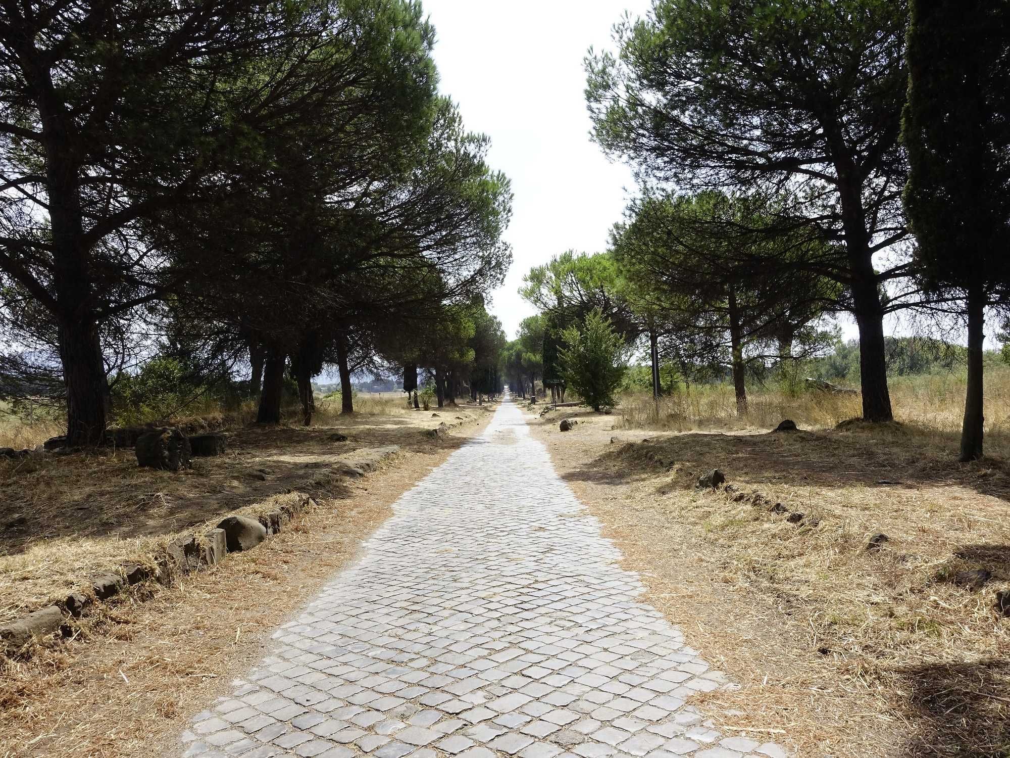
A new analysis has tested familiar claims about Roman roads against a digital reconstruction covering 299,171 kilometres, or about 186,000 miles. Published in Nature Communications on 15 September 2026, it examines how the network crossed the landscape, which routes connected the empire most effectively and how closely its geography resembles major roads today.
The findings qualify two persistent images. Roman builders favoured direct alignments where the terrain allowed, but the roads were not uniformly straight. Rome was politically and symbolically central, yet it was not the principal intermediary in the empire-wide land network. Several provincial capitals occupied stronger positions for overland movement.
That conclusion is narrower than several headlines suggest. The study models terrestrial routes rather than the full transport system, and its map combines roads used at different times. Rome’s position on Mediterranean shipping routes, and the importance of river traffic elsewhere, therefore remain outside the calculation.
One Study Behind Eight Reports
Eight reports published between 15 and 18 September presented the same development in different terms, from a road-network “myth” being overturned to the scale and durability of Roman engineering. They all lead back to one peer-reviewed analysis and to Itiner-e, the digital atlas on which its calculations were based.
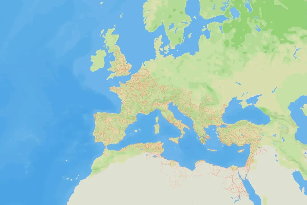
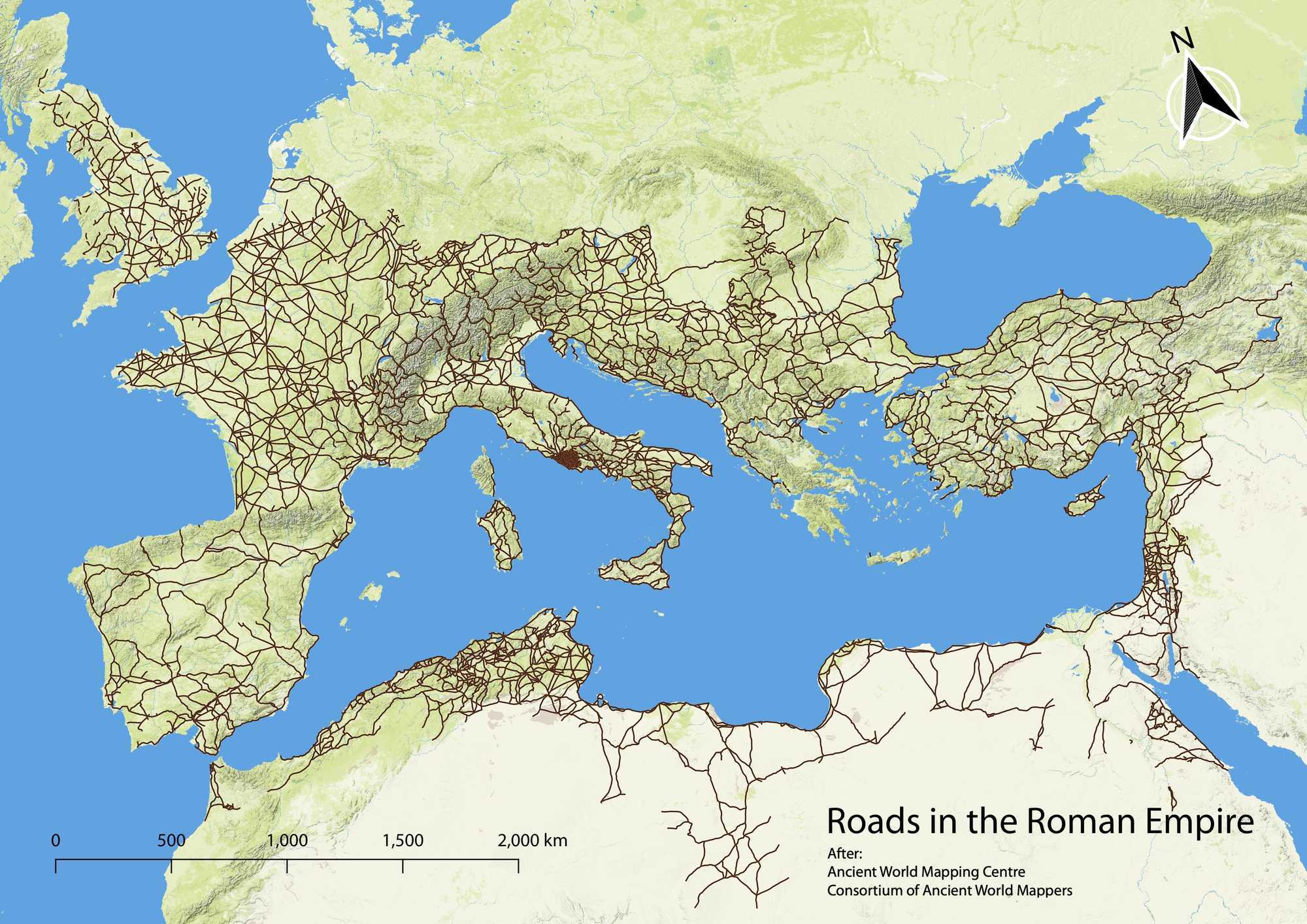
Itiner-e was released as an open research dataset in 2025. Its compilers assembled roads from excavation reports, milestones, ancient itineraries, regional studies, historical maps and remote sensing. The result contains 14,769 road segments, with about one third classified as main roads and two thirds as secondary routes.
The atlas nearly doubles the 188,555 kilometres represented in an older digital dataset, but the increase does not mean that every added kilometre was newly found in the ground. It reflects broader regional coverage and more detailed lines that follow real passes and terrain instead of connecting points with simplified straight segments.
Measuring a Network, Not Repeating a Proverb
The new study converted the road map into a network of 10,516 nodes and 14,901 edges. It then measured which roads most often lay on the shortest travel-time paths through that network. This form of centrality identifies important intermediaries; it does not rank cities by population, wealth or political authority.
The highest-centrality land corridor ran along Mediterranean coasts in North Africa and the Levant, through Antioch and Anatolia, across the Bosporus at Byzantium, then through the Po Valley and southern France. Rome lay away from this empire-wide corridor because the Italian peninsula forms a long projection from the continental network.
Even within Italy, the most central road in the model followed the Adriatic side rather than passing through Rome. This does not erase the capital’s major Italian arteries, including the Appian Way and its route towards the Adriatic. It shows that a road important to Rome is not automatically the best intermediary for journeys across the whole empire.
Provincial Capitals Formed Their Own Hubs
The analysis found that provincial capitals were commonly placed where they could serve their own regions. Thirty-five of the 45 capitals tested reached the top decile on at least one of the study’s centrality measures, while 24 stood in the top two deciles for empire-wide intermediary importance.
Antioch, Ancyra, Byzantium and Corinth were better located than Rome for empire-wide terrestrial mobility. Some provinces centred movement on a particular city, including Corinth in Achaia and Ancyra in Galatia. Others had linear systems shaped by rivers or coasts, or more distributed networks with several important roads.
Main roads were also more likely than secondary roads to occupy strategically important positions in 40 of the 43 provinces where both categories could be compared. The result quantitatively supports the traditional classification of milestone-marked and itinerary-recorded arteries as the main intermediaries of provincial land travel.
Roman Roads Were Straight Within Limits
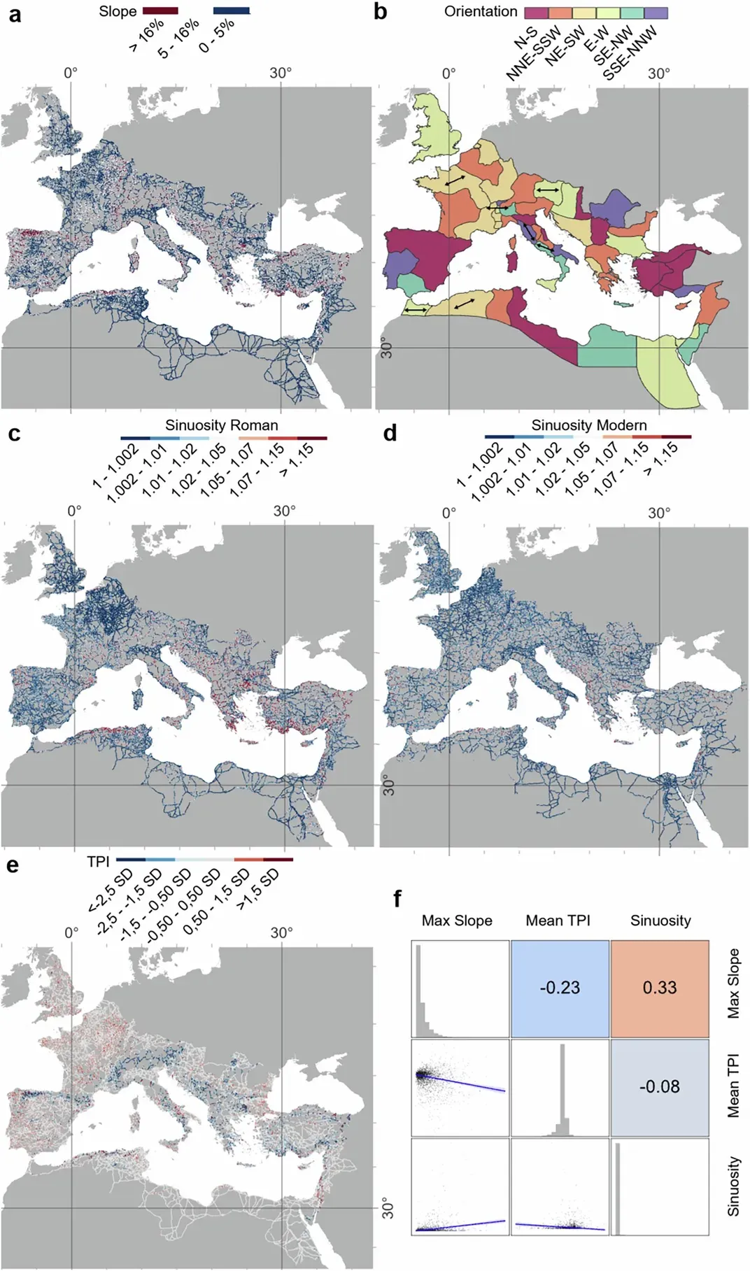
The study’s measurements support part of the reputation for straight Roman roads. Routes across lowlands in western Europe, North Africa, the Po Valley, central Anatolia and Syria generally had low sinuosity. Main roads were slightly straighter than secondary ones, consistent with more intensive planning of major public and military corridors.
Topography nevertheless shaped the network. Roads through mountains followed valleys, ridges and passes, while 90.57 per cent of the mapped length remained below the study’s upper gradient threshold for possible wheeled traffic. The researchers found Roman roads less straight overall than major modern roads, whose builders can alter terrain with much more powerful machinery.
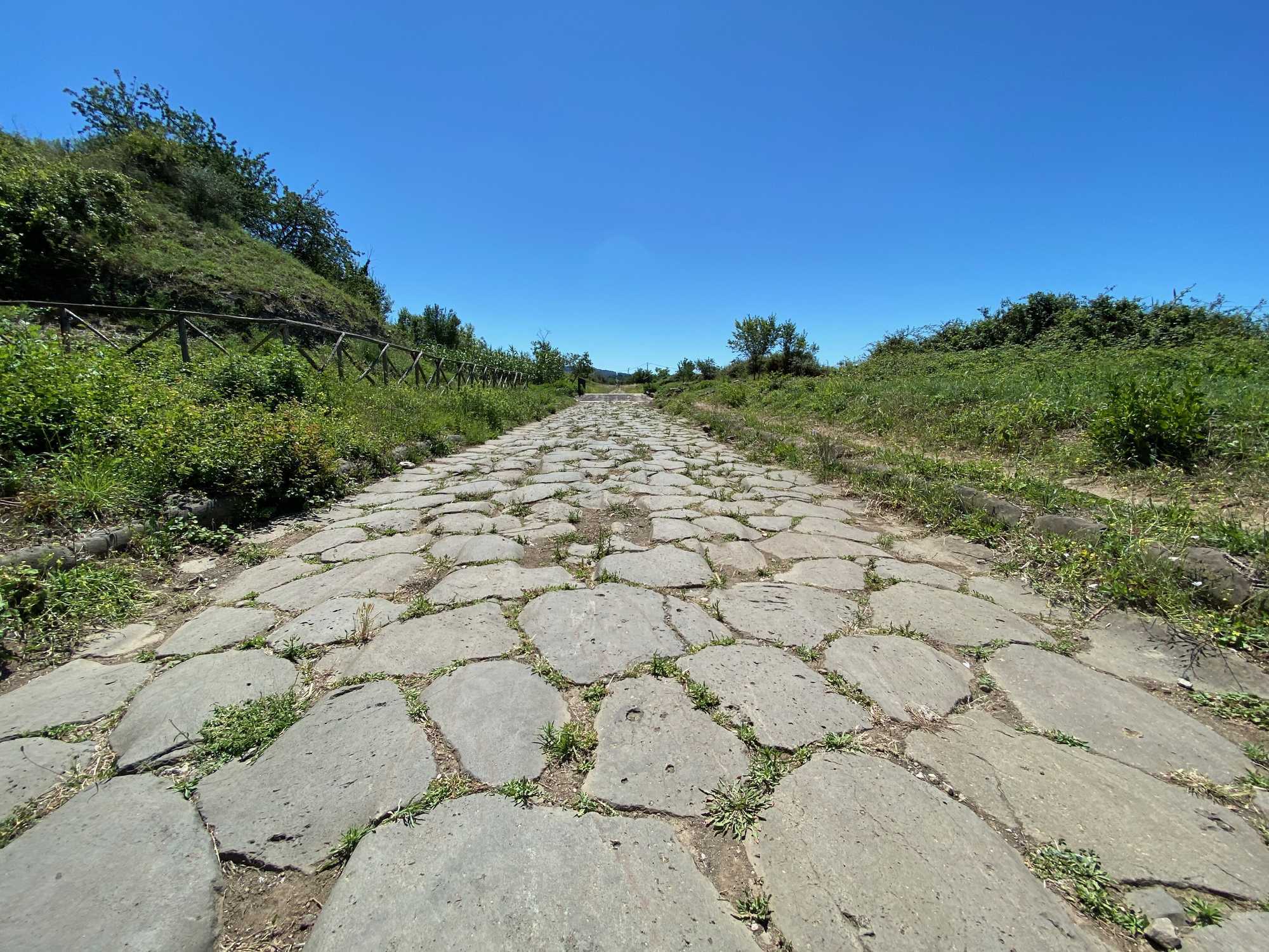
Roman engineering still changed difficult landscapes through cuttings, terraces, retaining structures, bridges and occasional tunnels. Trajan’s bridge and the roadworks at the Danube illustrate the scale such interventions could reach. The new result is not that Roman builders avoided obstacles, but that directness was balanced against terrain and available technology.
Ancient and Modern Roads Overlap Unevenly
Roman and major modern road density showed a moderate positive correlation across the former empire. The relationship was not uniform: local geography, settlement history and later political and economic change produced different patterns from one region to another.
The analysis found no continuous large region in which Roman roads alone strongly predicted modern infrastructure. It also found only a weak relationship between Roman roads and present-day population density. The results therefore do not support a single empire-wide claim that Roman construction determined every later transport pattern or modern centre.
They do show that ancient corridors can remain influential at local and regional scales. Some routes continued to carry communications into the medieval period, while later roads sometimes followed comparable passes or coastal lines. The paper presents that persistence as measurable but varied, rather than as proof that modern highways simply reproduce a Roman plan.
What the Map Cannot Yet Show
The road atlas is a reconstruction, not a complete survey of surviving pavement. Only 2.737 per cent of the mapped length has a location classified as certain; 89.818 per cent is conjectured and 7.445 per cent hypothesised. Coverage also varies with the intensity of archaeological research in different regions.
The map represents routes used during the Roman period around the empire’s maximum extent, including some roads that existed before Roman conquest. Comparable dates for construction, alteration and abandonment are unavailable across the whole territory, so the model cannot show whether every route operated at the same time or how the network changed century by century.
Most importantly, the study excludes sea and river transport. Italy, Greece, North Africa and major ports would probably appear more central in a combined model. Rome’s role in the Roman navy and Mediterranean sea routes remains compatible with the new result: the capital was not the empire’s leading overland intermediary, but the analysis does not measure every road, river and sea lane by which the Roman world moved.


About the Roman Empire Times
See all the latest news for the Roman Empire, ancient Roman historical facts, anecdotes from Roman Times and stories from the Empire at romanempiretimes.com. Contact our newsroom to report an update or send your story, photos and videos. Follow RET on Google News, Flipboard and subscribe here to our daily email.
Follow the Roman Empire Times on social media: