
Roman Fort at Golubac Reveals High Walls and a Resident’s Name
Excavations at Cuppae in Serbia reveal changing Roman defences and a funerary monument that gives ancient Golubac its first known named inhabitant.

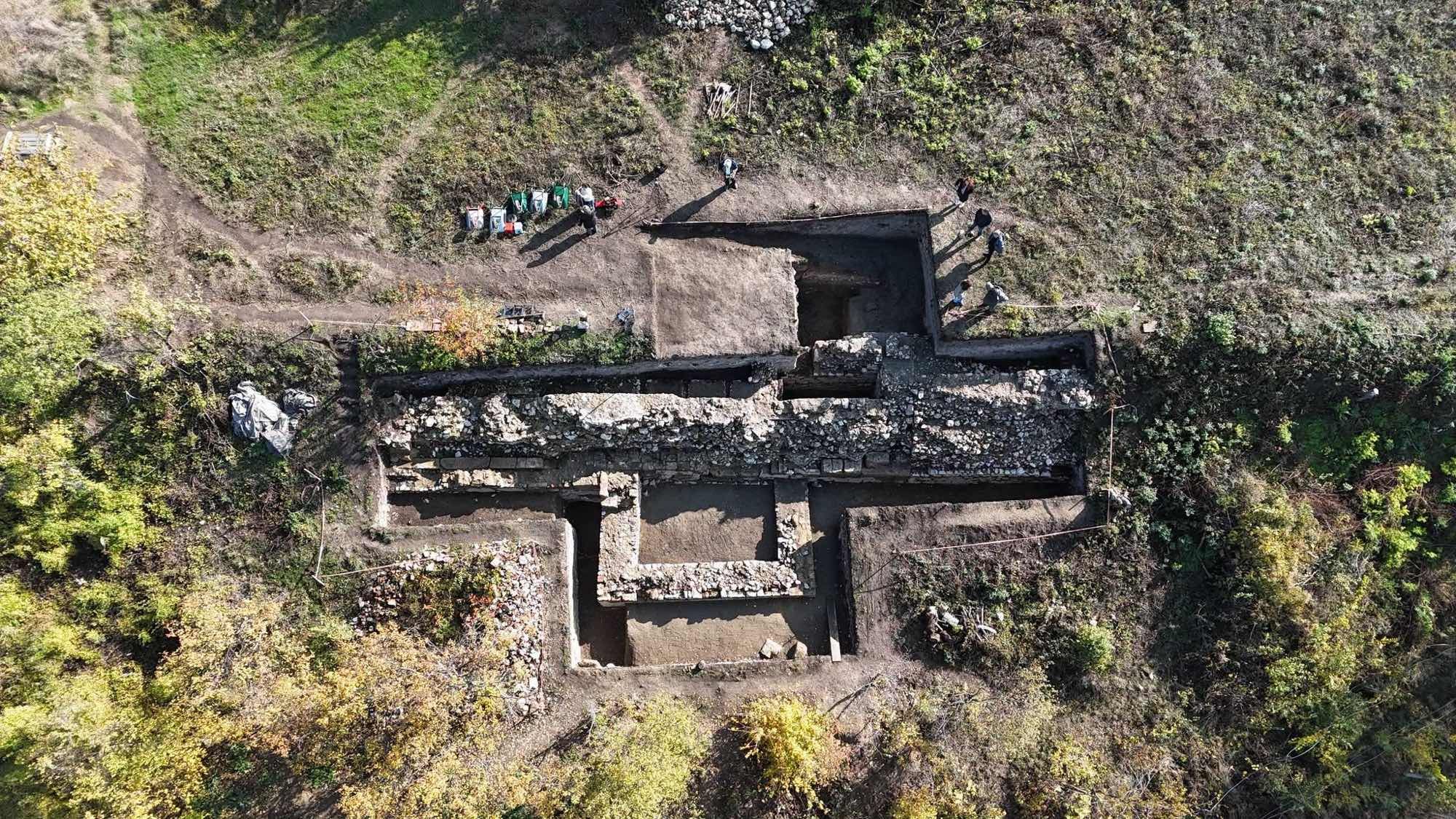
Excavations at the Roman fort of Cuppae in Golubac, Serbia, have uncovered a western defensive wall surviving up to four metres (about 13 feet) high and a funerary monument naming Titus Ulpius Flavius. The Institute of Archaeology in Belgrade identifies him as the first inhabitant of ancient Golubac known by name.
The institute announced the results on 12 November 2026, following the continuation of a systematic excavation programme begun in 2025. Work has concentrated on the western part of the fort, where archaeologists have investigated substantial masonry and towers belonging to different stages of construction along Rome’s Danube frontier.
The team provisionally dates the fort’s construction to the second century AD. A projecting tower belongs to the fourth century, while portable finds indicate occupation continuing into the sixth. Together, the architectural remains and objects document several centuries of activity at a military site in the Lower Danube region.
A western wall survives above the foundations
The latest work has exposed a massive defensive wall on the western side of Cuppae. Its masonry reaches the reported height of four metres (about 13 feet) in the surviving remains. The investigation therefore includes substantial standing fabric as well as the lines of walls preserved near ground level.
Beside the wall, archaeologists found part of an inner tower assigned to an earlier building phase. A later tower projects beyond the defensive line. The institute reports that this fourth-century structure has now been fully investigated, providing a dated element within the fort’s developing architectural sequence.
The excavation team is using these remains to establish the fort’s construction phases and development. Its second-century foundation date remains preliminary, while the two tower phases distinguish earlier arrangements from the later projecting defence. The announcement presents Cuppae as a fort modified over time within the empire’s river-frontier system.
A funerary monument preserves a personal name
The monument bearing Titus Ulpius Flavius’s name is one of the discoveries singled out by the excavation team. It introduces a named person into the archaeological record of ancient Golubac, alongside the walls, towers and portable objects recovered during the continuing investigations.
The institute describes the stone as a funerary monument and identifies Flavius as the settlement’s first known named inhabitant. It publishes his name without identifying an occupation or military rank.
Evidence for a cemetery at Cuppae was already included in Serbia’s 2020 description of its Danube frontier sites. That earlier account recorded a settlement and numerous surface finds around the fort. The newly announced monument adds an individual’s name to this previously documented setting of fortification, settlement and burial.
Cuppae stood beside the Iron Gates route
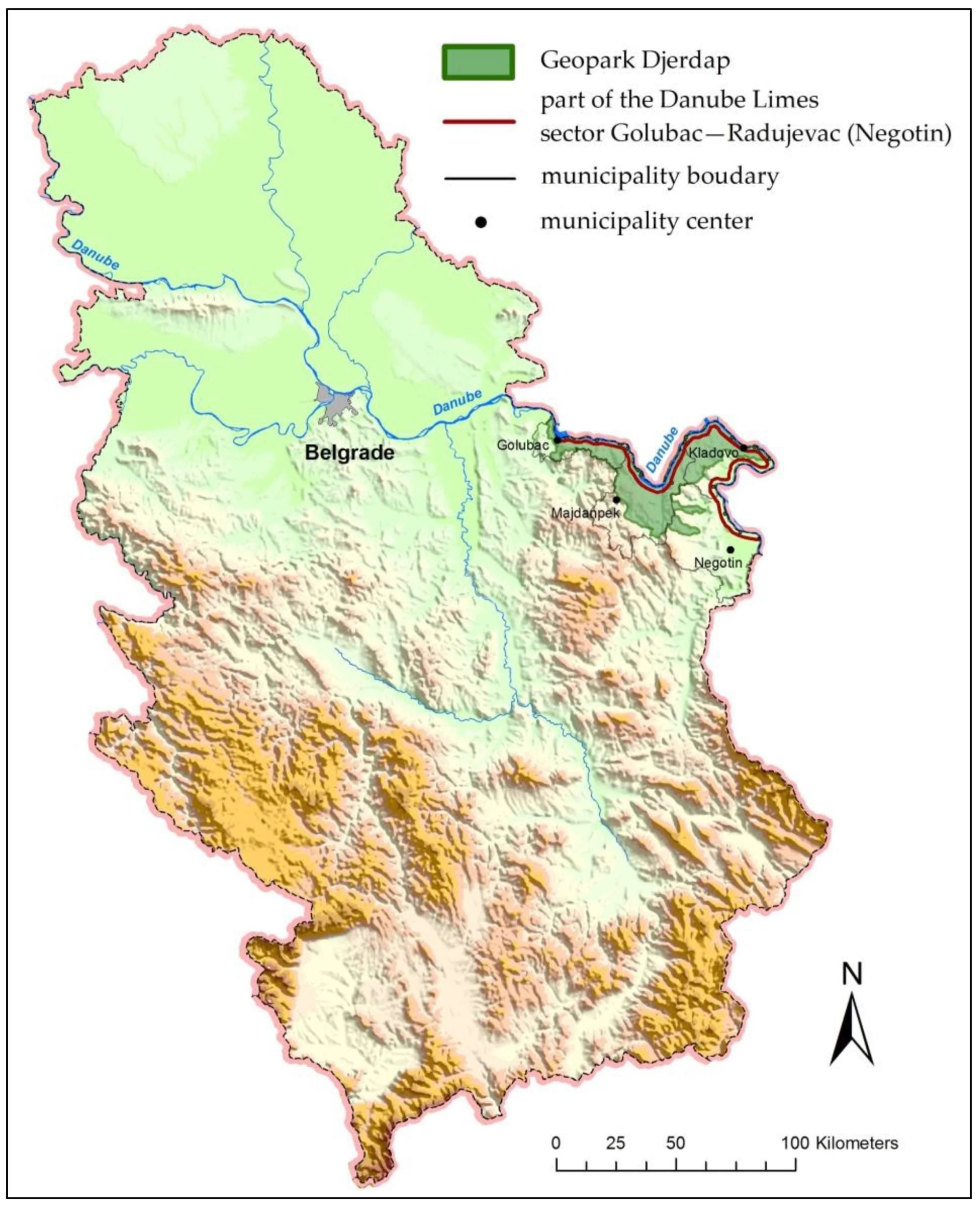
Golubac lies at the western end of the Iron Gates region, where the Danube passes through a long gorge towards Drobeta, modern Drobeta-Turnu Severin in Romania. Research on the Upper Moesian frontier describes this stretch as approximately 130 kilometres (81 miles) long, with rapids and banks that were difficult to reach.
The terrain shaped the distribution of Roman military installations. Large legionary bases required more space and generally occupied flatter stretches, while auxiliary forts, smaller posts and watchtowers guarded the constricted gorge. Viminacium, west of Golubac, was the base of the Seventh Claudia legion; Singidunum, at modern Belgrade, housed the Fourth Flavia legion.
Roads and river transport connected these installations. The frontier road linked military posts and associated settlements, and boats carried troops, goods and supplies. The engineering of Rome’s road network had a particularly demanding local setting here: parts of the Iron Gates route were cut into rock or extended on supports above the river.
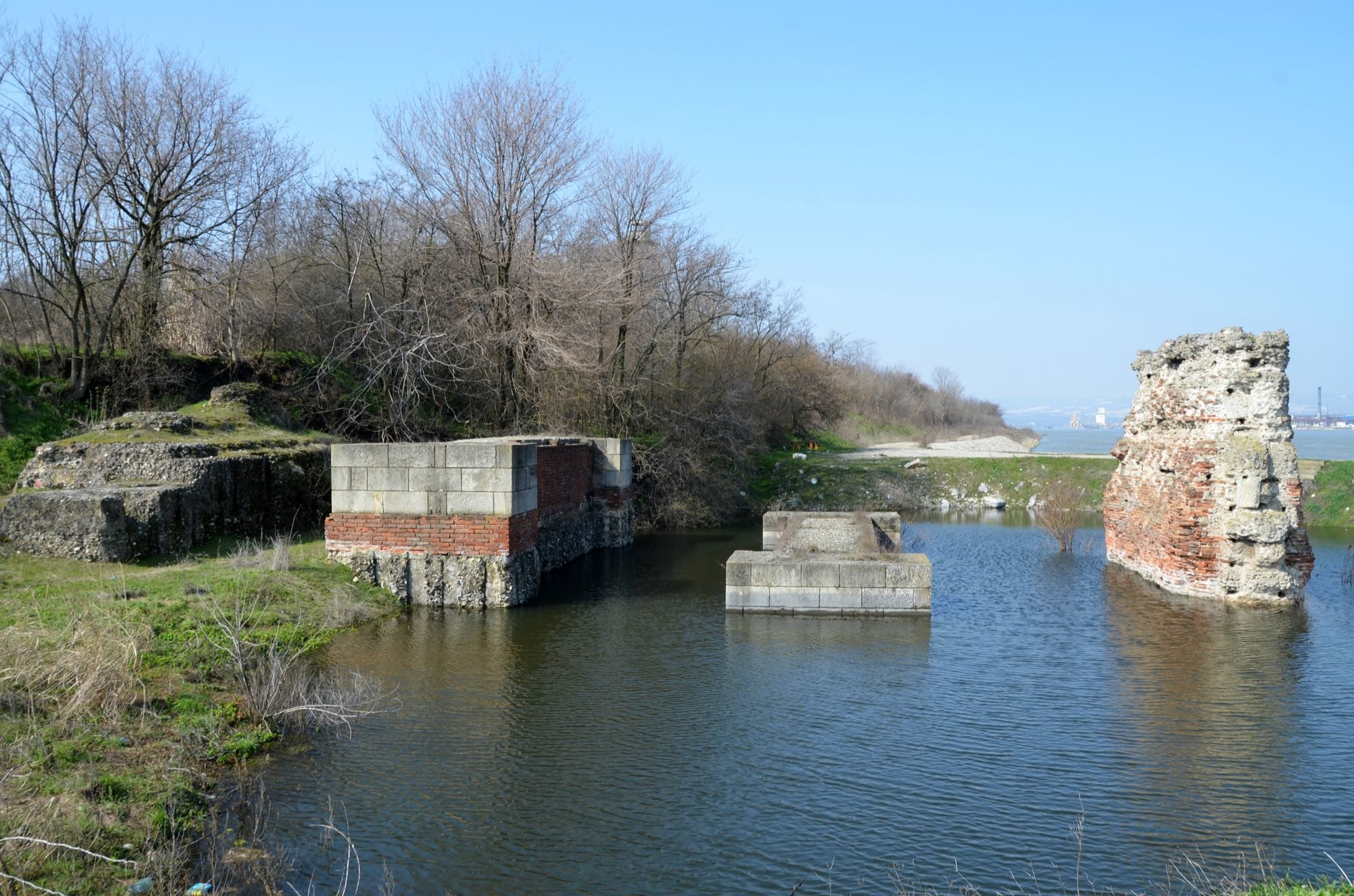
Preparations for Trajan’s Dacian wars included major work on communications along this frontier, including completion of the gorge road and the excavation of a navigation channel at Sip. Farther downstream, Trajan’s bridge across the Danube connected the Roman bank with Dacia. Cuppae belonged to this wider landscape of forts, routes and crossings.
Projectiles, pottery and a small cross
The excavations have produced several hundred archaeological finds. The institute’s announcement lists pottery fragments, bone objects, artillery projectiles and Roman bricks carrying animal footprints. The assemblage brings together military equipment, ceramic vessels and building materials recovered alongside the defensive architecture.
The marked bricks form part of a material record extending beyond stone construction. They are among the objects highlighted by the team, together with the projectiles and worked bone. Our account of Roman brick production follows the wider processes of preparing, shaping, drying and firing such ceramic building materials.
A small cross-shaped pendant is associated with the latest occupation phase. The institute places the site’s continuing life into the sixth century on the evidence of portable finds. This extends the reported occupation beyond the fourth-century projecting tower and includes a personal object among the discoveries from the fort’s later history.
Known ruins enter a new excavation phase
Cuppae was documented before the current campaign. In the description submitted by Serbia to UNESCO in January 2020, its walls, towers and internal buildings were visible on a hill above the Danube bank, with modern Golubac occupying part of the surrounding setting. The account described massive fortification remains on the surface and slopes.
That submission recorded evidence for auxiliary units and detachments of the Fourth Flavia and Seventh Claudia legions. It also stated that archaeological excavation had yet to take place and that geophysical survey was in progress. The programme begun in 2025 has since brought systematic excavation to the western defences.
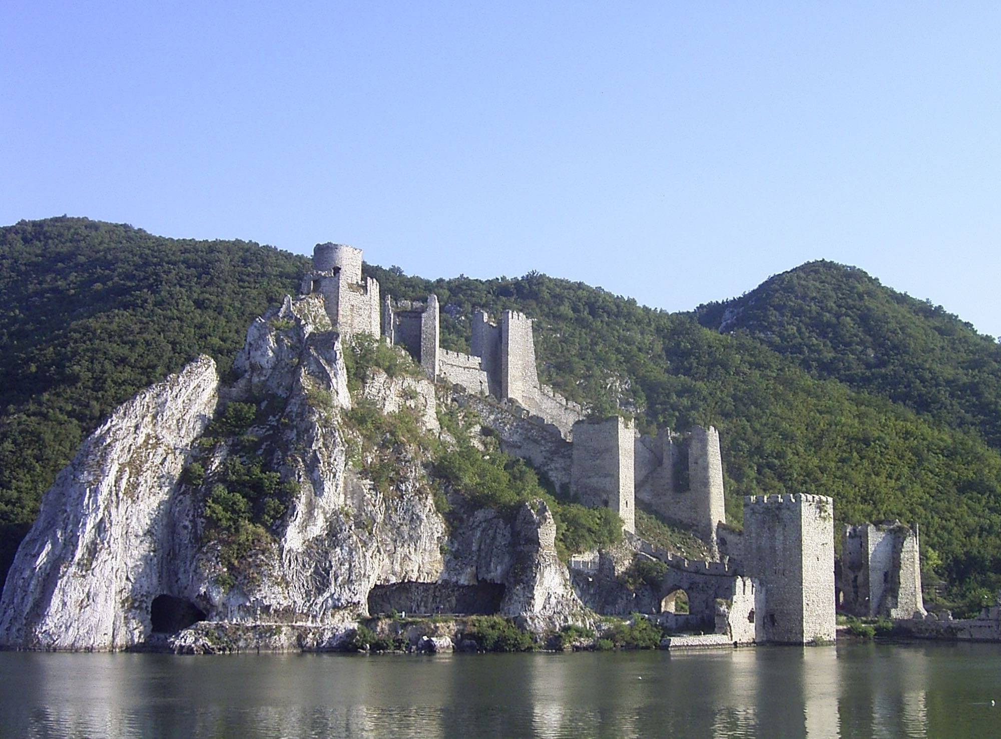
The same heritage inventory lists Cuppae and the Roman road below the medieval Golubac Fortress as separate components. Both belong to the region’s longer archaeological landscape. The current announcement concerns the Roman fort in Golubac, while the well-known medieval fortress is also included among the area’s heritage attractions.
Research supports plans for an archaeological park
The excavations are directed by Milica Marjanović of the Institute of Archaeology and Saša Živanović of the National Museum in Požarevac. The participating institutions also include the Municipality of Golubac and the Regional Institute for the Protection of Cultural Monuments in Smederevo. Funding comes from the municipality and Serbia’s Ministry of Culture.
The work contributes to broader activities connected with the nomination of the Roman Danube frontier for UNESCO World Heritage recognition. Serbia’s Danube Limes is recorded on the Tentative List, submitted in 2020. Cuppae forms one element of a proposal encompassing fortifications and the settlements, cemeteries and infrastructure associated with the frontier.
The institute also links continued investigation with plans to develop and present the site as an archaeological park. Its proposed visitor setting would connect Cuppae with the medieval fortress, Tumane Monastery, Đerdap National Park and the Danube. For now, excavation has established a clearer architectural sequence and recovered the name of an inhabitant from ancient Golubac.

About the Roman Empire Times
See all the latest news for the Roman Empire, ancient Roman historical facts, anecdotes from Roman Times and stories from the Empire at romanempiretimes.com. Contact our newsroom to report an update or send your story, photos and videos. Follow RET on Google News, Flipboard and subscribe here to our daily email.
Follow the Roman Empire Times on social media: