The Appian Way: Europe’s Most Travelled Road, is not a Modern Highway
The Appian Way, known as Via Appia in Latin, is one of the most famous ancient roads of Rome.

The Appian Way, was a crucial transportation route in the Roman Republic and later in the Roman Empire, playing a significant role in the expansion and consolidation of Roman power. It has been named a Unesco world heritage site.
The road was built by Appius Claudius Caecus in 312 B.C. He was a Roman censor and the road was named after him. It was the Roman poet Statius that named the Appian Way, the queen of roads: regina viarum.
The story of the most travelled road
Robert A. Kaster in his book “The Appian Way: Ghost Road, Queen of Roads” gives a fantastic introduction to the most famous road of all times by saying that no road in Europe has been traveled by so many different people, with so many varied purposes, across so many generations. Standing in one spot with eyes closed, a traveler can almost imagine the ghosts of the past passing by, perhaps similar to the ones Cassius Dio saw in his dreams.
First, you would witness a Roman soldier, as his city expanded southward, imposing its power on the other tribes of the peninsula, who at times managed to resist. Then a craftsman, tradesman, or small farmer, bringing goods to towns like Minturnae, Aeclanum, or Venusia—key links in the civil life of the great empire.
More soldiers would follow, wave after wave, first sweeping up from the south with the power of Constantinople behind them, then down from the north—the Lombards, later the Normans, and many others—settling in strongholds like Beneventum, Melfi, and countless other hill towns where castles still dot the ridges. Pious travelers also took this route, heading to Jerusalem with directions that can still be traced today.
Closer to our time, says Kaster, scholars and statesmen traveled the road, some aiming to restore ancient parts of it during the eighteenth and nineteenth centuries (and continuing to do so today), while others followed it in pursuit of a unified Italy. If we could view the Appian Way like Vonnegut's Tralfamadorians, we would see a long journey beginning with Appius Claudius Caecus, who conceived and named the road, and ending with Garibaldi's horse.
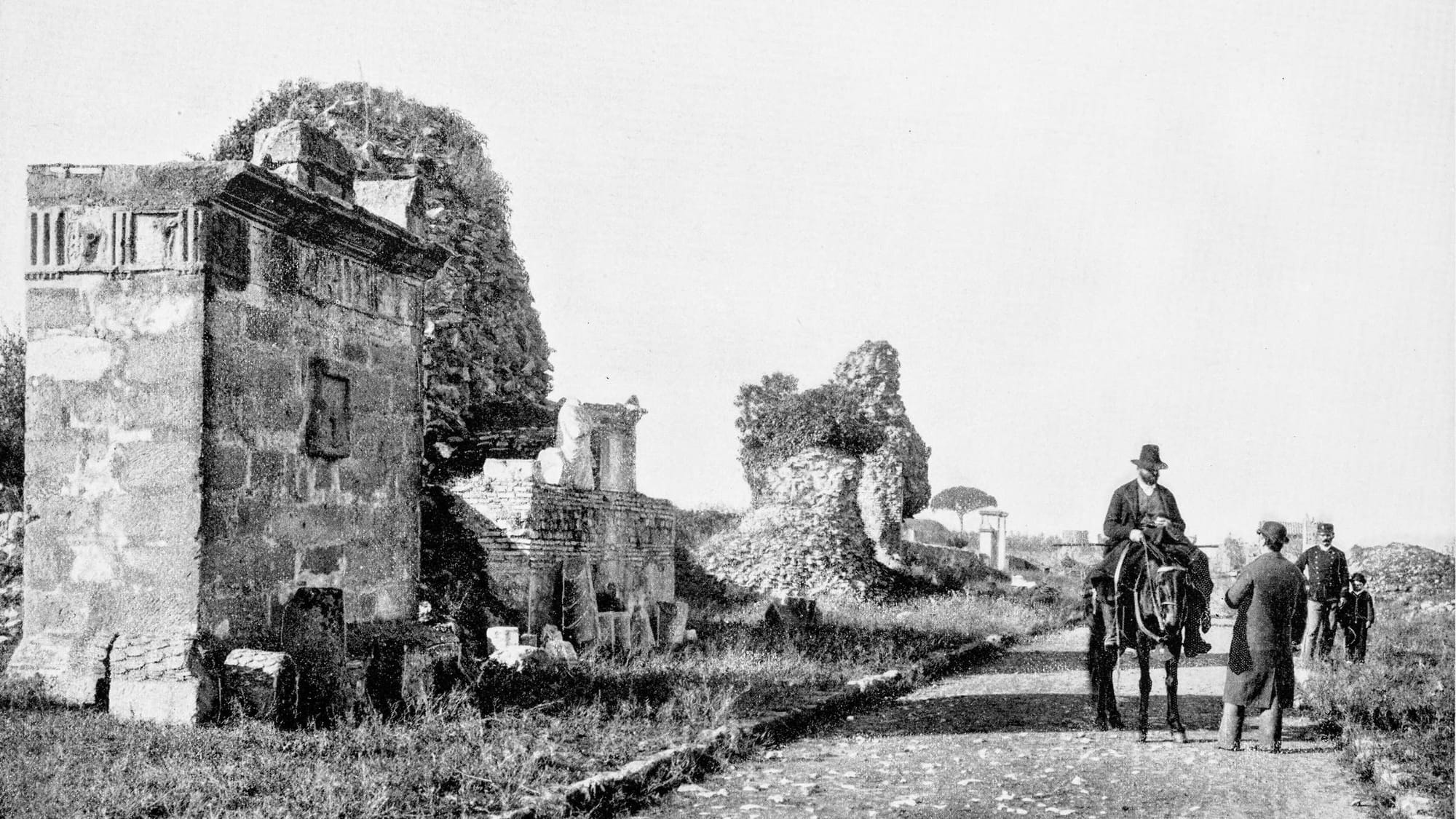
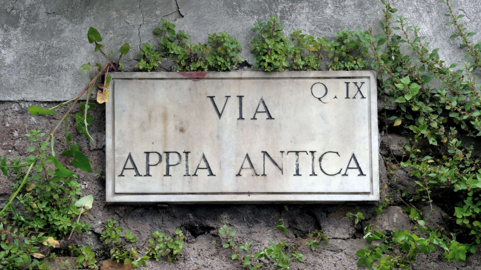
Kaster and his wife, began their day at the spot where the Appian Way once started, at the porta Capena, the main gate in the southeast quadrant of Rome's oldest walls. These walls—the Servian walls, said to have been built by King Servius Tullius in the mid-sixth century BCE—are long gone, as is the gate.
The Appian Way is also gone there, replaced by one of the busiest intersections in modern Rome, where traffic flows to and from the Colosseum or past the broad expanse of the Circus Maximus. However, a plaque on a clump of ancient brick ruins marks the inizio della via Appia, and it's easy to follow the path from there, across several lanes of traffic, along the route the road must have taken, to the point where it split off from the via Latina, which headed more easterly toward the hills where Roman grandees had their villas.
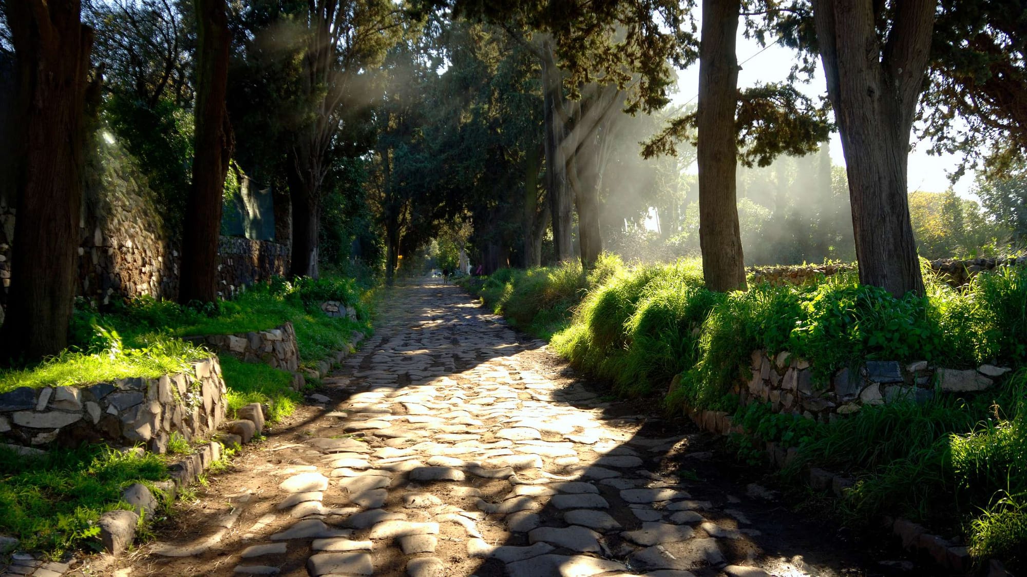
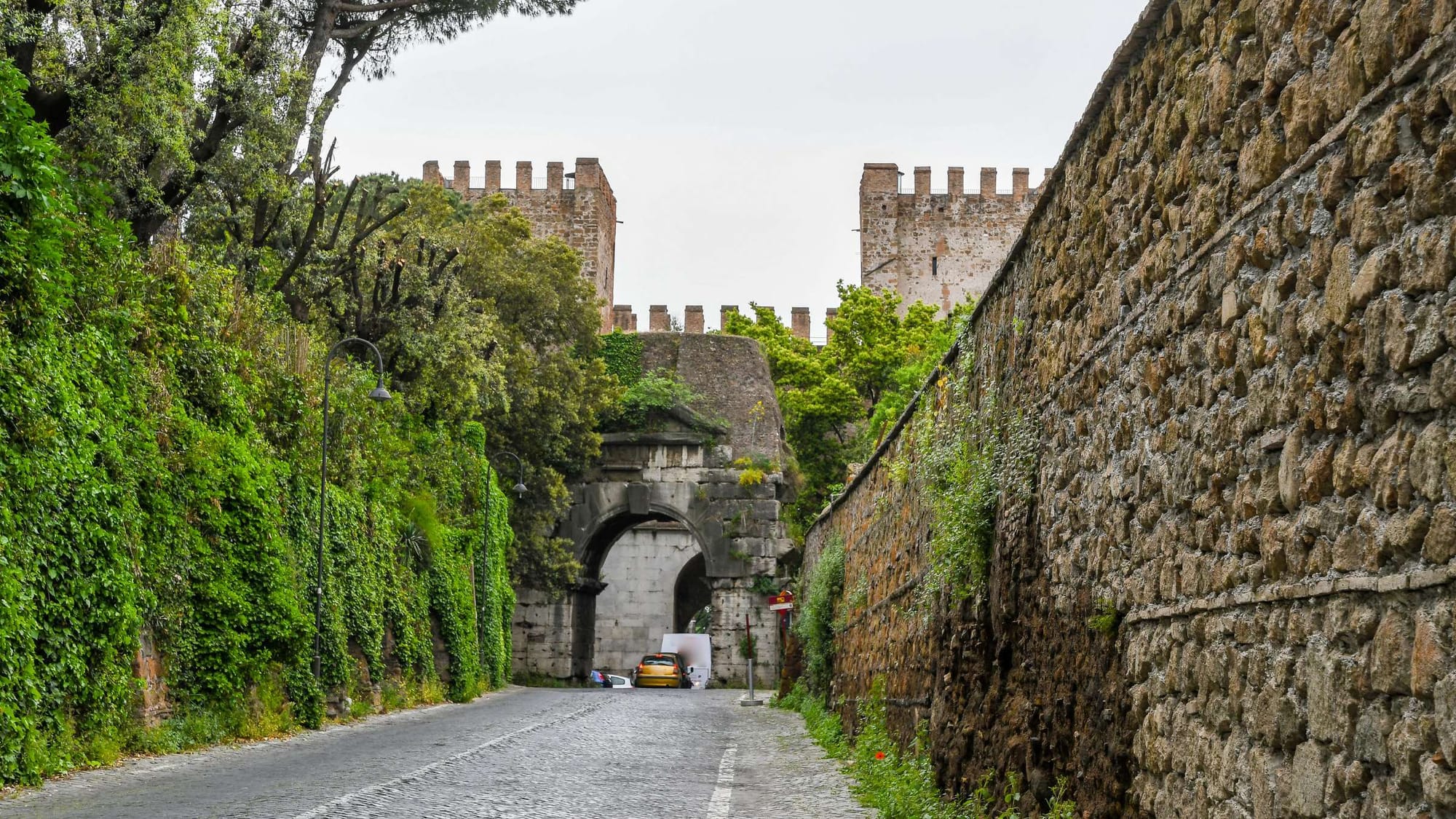
About half a mile from that point, at the end of a gentle incline, another gate—the ancient porta Appia, now the porta San Sebastiano—is set in another wall, the Aurelian, which, though much younger than the Servian wall, is still eighteen centuries old today and remains intact.
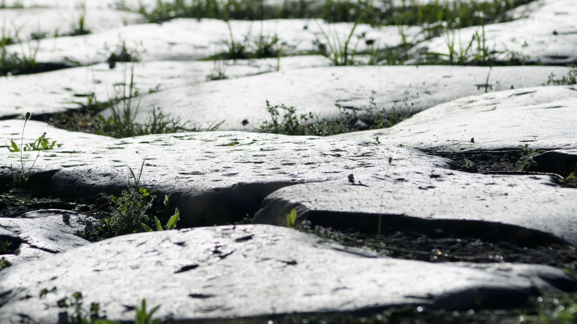
Just beyond the porta San Sebastiano stood the first of hundreds of inscribed milestones; a replica stands there today, roughly marking the spot where the modern archaeological "park" begins (the term "park" is used loosely).
For about half a mile, from the milestone to the gate of the San Callisto catacombs, as the Appian Way descends to the bed of a small stream (the Almo) and then curves left to climb back uphill, the road is simply unattractive: after passing a commercial strip (a car dealership, an auto repair shop, storefronts), businesses give way to private homes and high walls that create an almost unbroken barrier on both sides of the road. The next stretch, from the San Callisto gate to the San Sebastiano catacombs, is both unattractive and dangerous. The road remains confined by high walls, but now any semblance of a proper walkway is gone: a narrow pedestrian strip is separated from the driving surface by only a painted white line, which drivers often ignore as they speed in both directions, sometimes creating three lanes of traffic in a space no more than thirty feet wide from wall to wall.
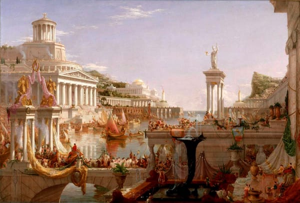
The road network designed and built by the Romans to achieve their grand vision of power created a landscape where diverse territories and peoples were connected despite their distances, unified by this vast infrastructure.
Until the eighteenth century, European civilization had no road system more efficient than that of classical Rome. The remnants of this extensive network remain a constant presence throughout much of the Mediterranean region. Ancient Rome's grand ambition to rule the entire world was closely tied to its impressive road network, which spanned over 120,000 kilometers and connected much of Europe with the Mediterranean.
Although this grand dream was ultimately undone by the Germanic invasions, which ironically used these well-conceived roads to their advantage, the legacy of this utopian vision still lingers. In Northern Campania, traces of this ancient network can still be found at archaeological sites, quietly preserving the historical memory of Rome's great ambition.
The beginning of the Appian Way
The Romans were exceptional road builders, surpassing even the United States in the sheer extent of their construction, with 53,000 miles of roads compared to the 43,000 miles of the American Interstate system.
The lasting nature of Roman roads highlights their durability and outstanding construction, as seen in the Appian Way, parts of which remain in use today after approximately 2,300 years. Some believe that the phrase "All roads lead to Rome" refers to the Milliarium Aureum, a golden column in the Roman Forum marking the point where all Roman roads converged.
While the meaning of the phrase may have evolved, the Appian Way, continues to demonstrate the intricate Roman road-building techniques and holds a fascinating history essential to the rise of the Roman Empire. Between 313-309 B.C.E., during Rome’s second Samnite war and before the Punic Wars and conflicts with Pyrrhus, Appius Claudius constructed two enduring legacies—the Appian aqueduct and the Appian Way. These projects were intended to secure the wealthy city of Capua from the threat posed by the nearby Samnites.
The Appian Way, the first paved road built by the Romans, earned the title "queen of roads." This title was well-deserved, especially after its extension from Capua to the Adriatic city of Brindisium in 190 B.C.E., making it the primary route from southern Rome to Greece, Africa, and the East. Initially, the road stretched 132 miles (±212 km) from Rome to Capua, with further construction eventually extending it to a total of 410 miles (±660 km).
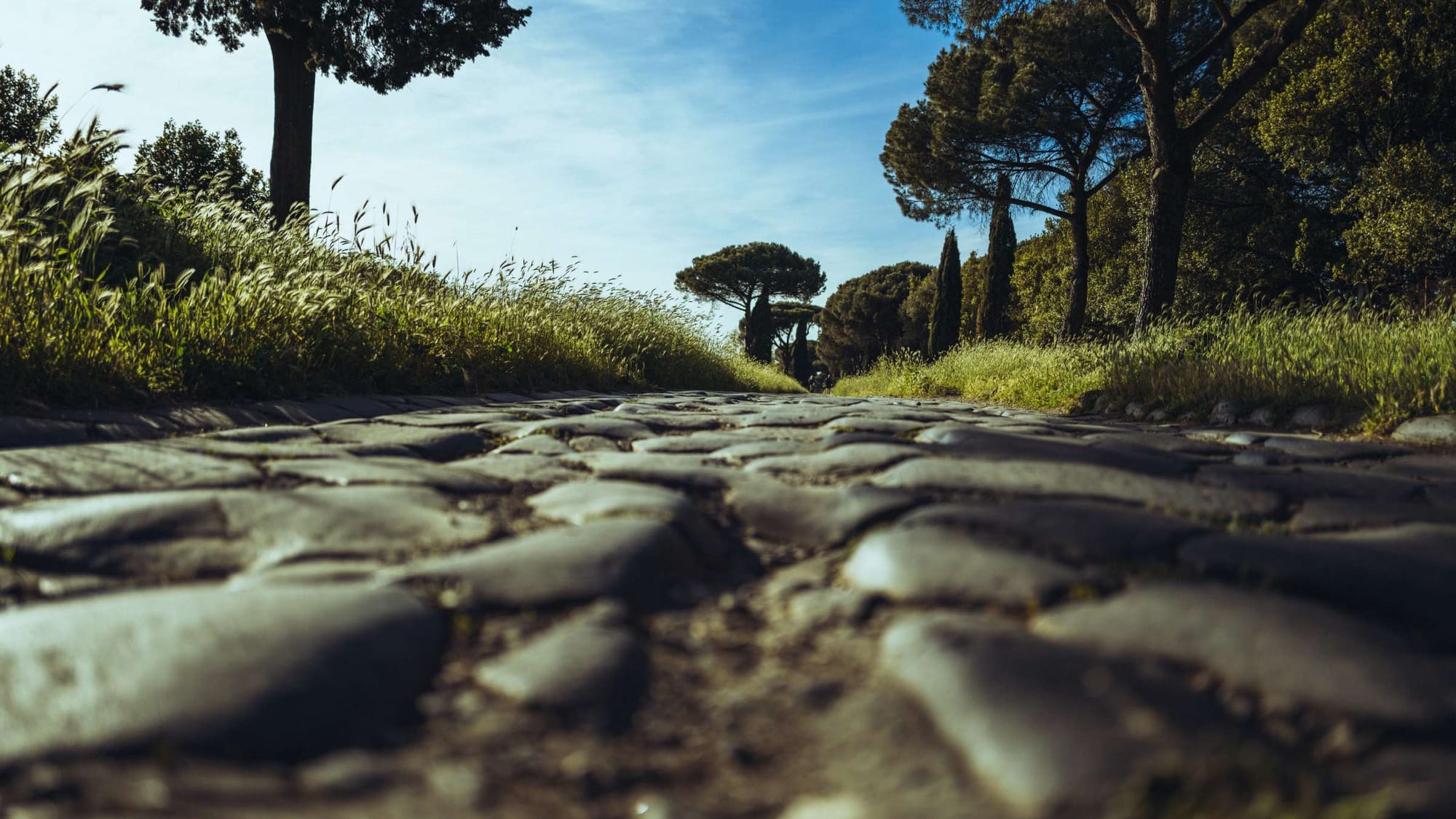
The Specs of the Appian Way
The Appian Way was constructed with a width of 36 Roman feet, or about 35 English feet (±11 meters), featuring a central two-way lane that was 15 1/2 feet (±4.7 meters) wide and bordered by curbs that were 2 feet (0.6 meters) wide and 18 inches (46 cm) high. These curbs flanked one-way side lanes measuring 7 3/4 feet (2.36 meters) in width.
To mark the road’s path, builders would typically dig parallel trenches about 40 feet (±12.2 meters) apart before laying down a foundation of sand and mortar. Four material layers were then applied: 1) the statumen, a 10 to 24-inch (25-60 cm) layer of large, flat stones; 2) the radus layer, a nine-inch (23 cm) thick layer of small stones mixed with lime; 3) the nucleus, a foot-thick (±30 cm) layer of Roman concrete made from gravel, sand, lime, and water; and 4) the summa crusta, a surface layer of tightly fitted lava stones arranged six inches (15 cm) deep.
The Roman road-building technique often included creating an embankment (agger), whose size varied depending on the road's importance and location. Major roads could have embankments up to five feet (±1.5 meters) high, while minor roads might lack them entirely. The widest roads (decumanus maximus) could be as broad as forty feet (±12.2 meters), whereas the narrowest might be just eight feet (2.44 meters) wide.
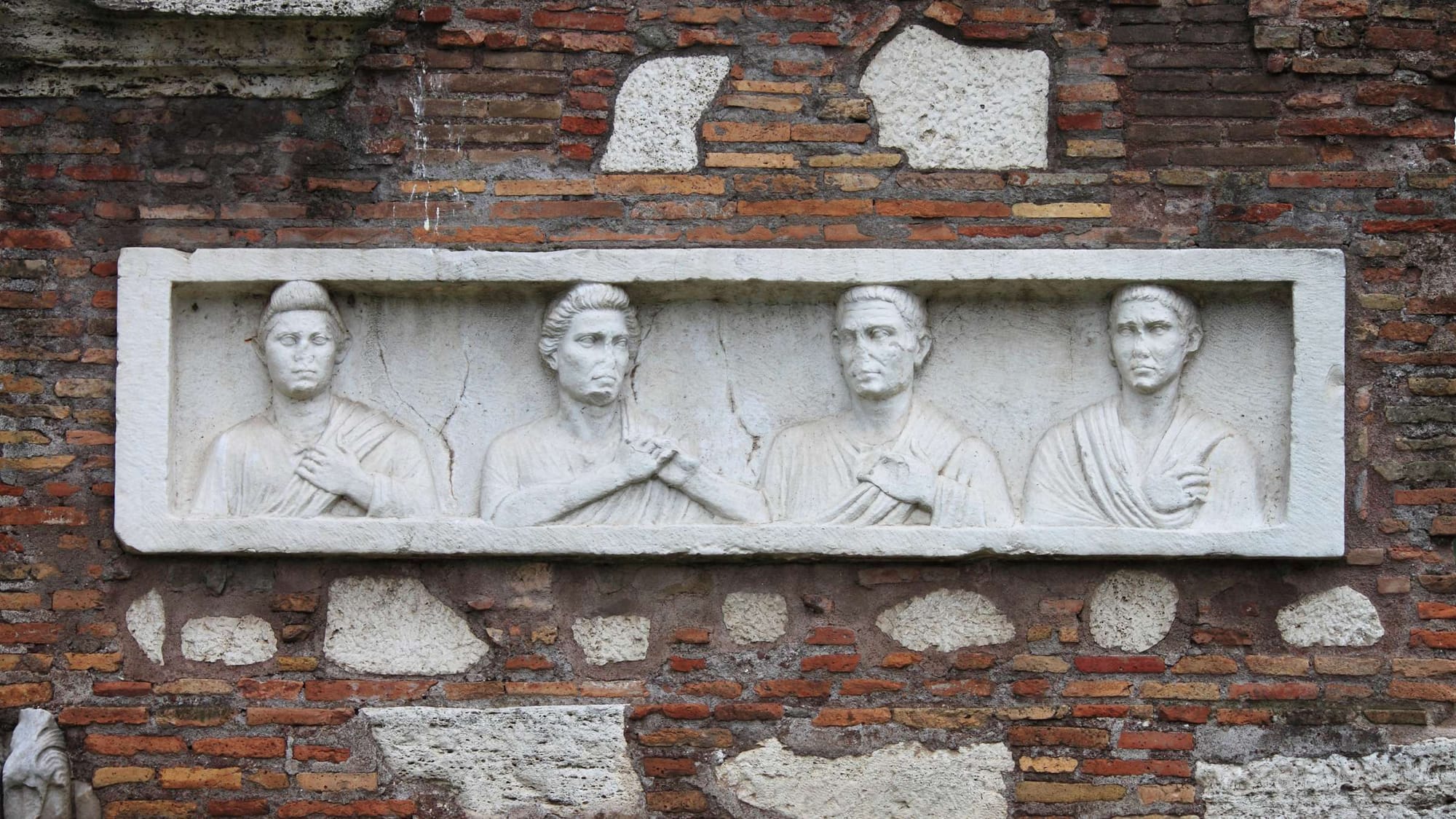
Roman roads were designed to accommodate various types of vehicles, such as the benna, a light cart for multiple passengers; the carpentum, a two-wheeled gig for women; the carrus, a luxury chariot used by officials; and the plaustrum, a two-wheeled cart for farmers transporting crops.
The tales of the Appian Way
Although the Bible doesn’t specifically name the road, evidence of Paul's journey along it is indicated by references to Puteoli, the Forum of Appius, and Three Taverns in Acts 28:13-15, marking it as an official record of traversing of the road.
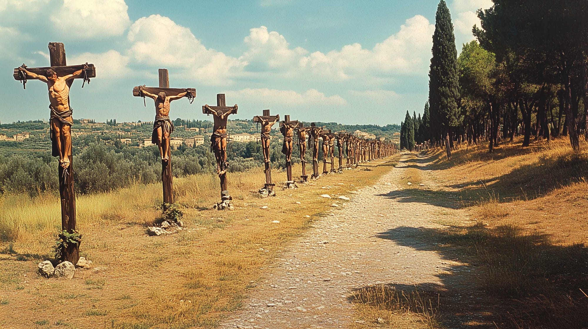
One of the most famous tales associated with the Appian Way, involves the gladiator and former slave, Spartacus, who led a massive slave revolt against Rome with an army that swelled to between 75,000 and 125,000 men. Spartacus’ forces were particularly powerful due to their core of gladiators, trained in Capua, who had been so severely mistreated that they rebelled against their oppressors.
With the Roman Army’s best troops scattered across the empire, Spartacus and his men posed a significant threat to Rome. The wealthy Marcus Crassus was the only one who volunteered to suppress the uprising, and he imposed strict discipline on his troops to carry out the task.
In 71 B.C.E., after a series of strategic maneuvers, Crassus finally managed to trap Spartacus' forces, leading to their defeat, though not without heavy losses among his own men. Spartacus fought bravely until the end, killing two centurions before dying in battle. In the aftermath, approximately 6,000 of the surviving slave soldiers were captured and crucified, their crosses lining the Via Appia from Capua to Rome.
A road that mirrored the Roman Empire’s flair
The landscape of Northern Campania underwent significant alterations due to the construction of the Appian Way during the Roman era. This vital roadway not only served to link Rome with the broader Mediterranean, enhancing territorial connectivity, but also played a crucial role in shaping the region's human-modified environment.
Despite being one of the lesser-known sections, the Appian Way in Northern Campania was integral to the Empire's expansive road network. The rerouting of the Appian Way in the 6th century AD marked a profound shift in the landscape, contributing to the decline of key economic hubs such as Minturnae, Sinuessa, and Foro Pompilio. (A traveler’s guide to the Appian Way by J. Bruce Langley)
The Appian Way also acted as a primary axis for the Roman system of land division, with the landscape still bearing traces of Roman agricultural infrastructure. In places like Ager Falernus, the ancient land divisions remain discernible in the road networks, irrigation channels, and property boundaries, which continue to be reflected in contemporary maps. The road was pivotal in facilitating economic, agricultural, and trade activities, leading to the emergence of renowned wine varieties like Caecubum and Falernum.
Roman engineering feats, including the construction of ports and the reclamation of marshlands, left an indelible mark on the Italian landscape. Even after the collapse of the Roman Empire, the landscape largely retained its Roman character, with many settlements and infrastructures from the Roman period continuing to shape the region's development.
The persistence of life and infrastructure from Roman times into the medieval period highlights the enduring influence of Roman engineering and planning on the region. (The Appian Way Today, vestige of a great utopia by Clelia Cirillo, Luigi Scarpa, Ugo Zannini, Giovanna Acampora, Marina Russo. CNR Naples Section Italy, Università Federico II 3Archeoclub d’Italia)

About the Roman Empire Times
See all the latest news for the Roman Empire, ancient Roman historical facts, anecdotes from Roman Times and stories from the Empire at romanempiretimes.com. Contact our newsroom to report an update or send your story, photos and videos. Follow RET on Google News, Flipboard and subscribe here to our daily email.
Follow the Roman Empire Times on social media: