
Lost Roman Town with 8,000-Seat Amphitheater Mapped in Austria
Surveys at Stein in Lower Austria reveal a planned Roman settlement and an amphitheater estimated for 8,000 people. Its identification as Claudivium remains uncertain.

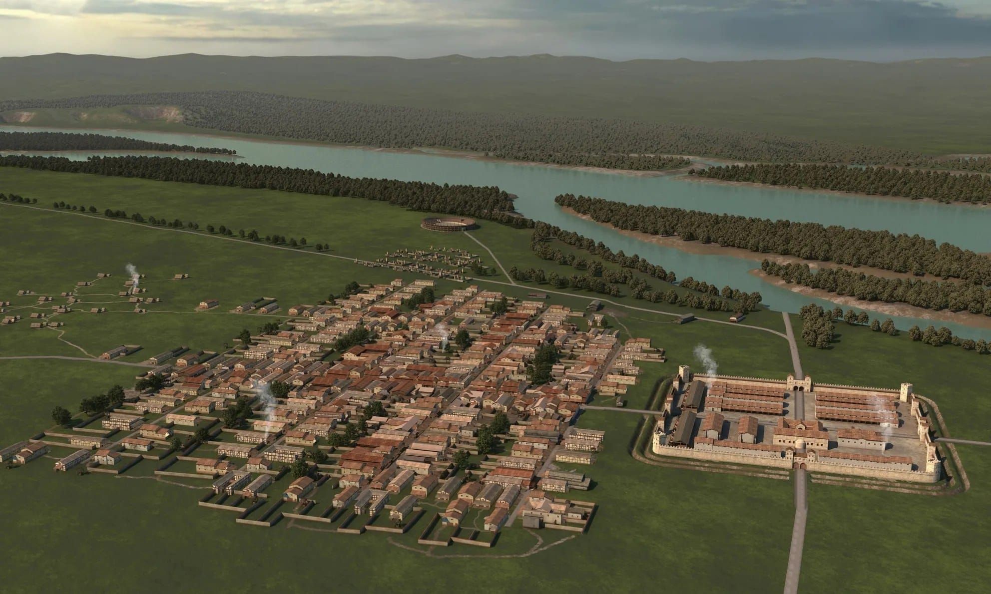
Archaeologists have mapped a planned Roman settlement beside the Danube at Stein, near St. Pantaleon-Erla in Lower Austria. The research team reports a regular street grid across an estimated 25 to 30 hectares and the outline of an amphitheater that it estimates could seat around 8,000 people. The features lie east of ancient Lauriacum, at present-day Enns.
The University of Innsbruck presented the findings on 25 September 2026; the settlement itself was not first noticed this year: finds had been collected in the area for decades, a nearby fort was identified in 2017, and the planned layout appeared in academic publications in 2024 and 2025. The amphitheater and the fuller picture of the site are the focus of the latest announcement.
The researchers consider the settlement a possible match for Claudivium, a place named by the second-century geographer Ptolemy. That name still remains a proposal. The surveyed structures, finds and coins establish an important Roman site, but they do not give it a securely identified ancient name or prove that it held the legal status of a self-governing town.
What the Surveys Show Beneath the Fields
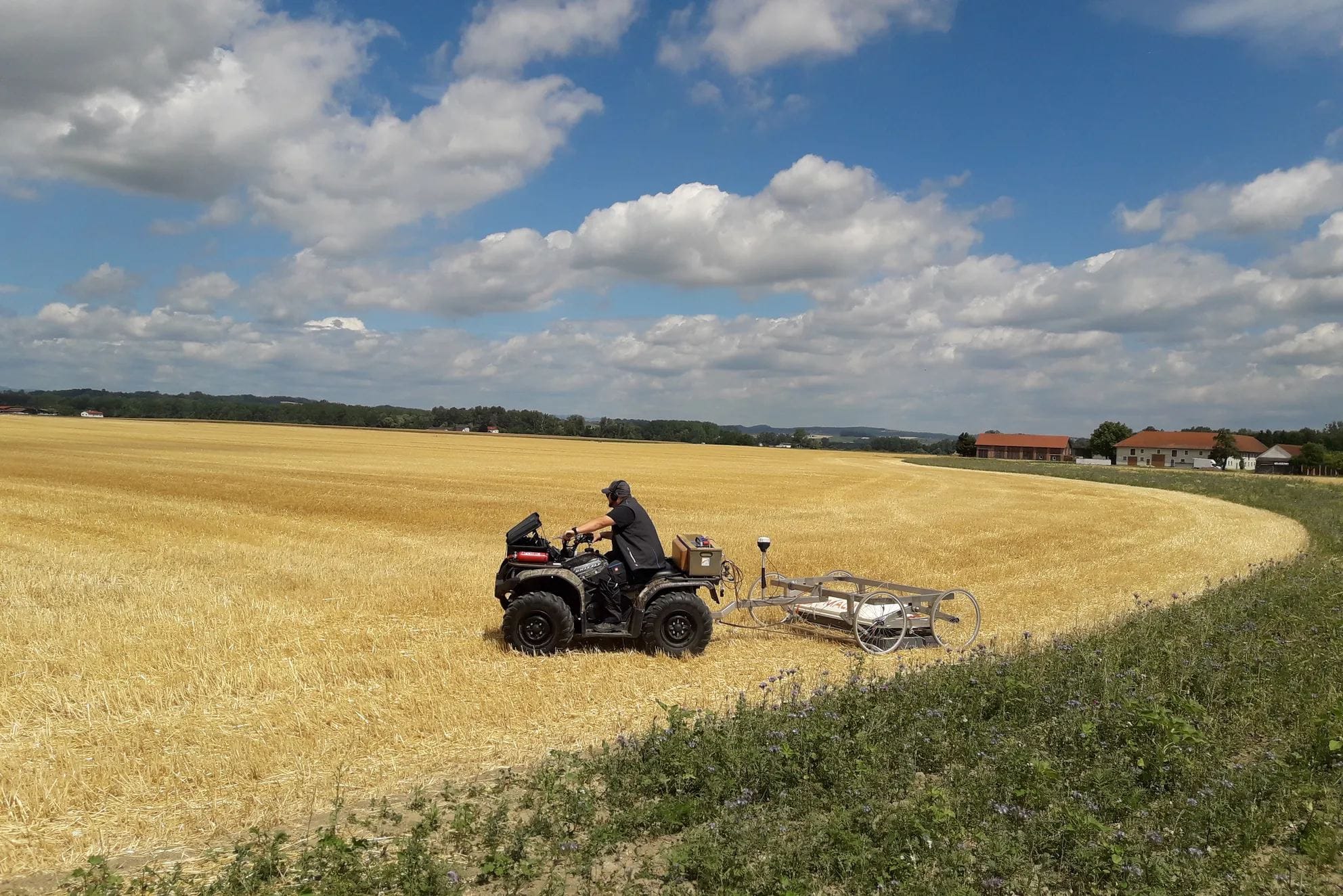
The published archaeological study describes how aerial photographs, magnetic measurements and ground-penetrating radar were combined to map structures below cultivated fields. By the time of its 2025 publication, magnetometry had covered about 100 hectares and radar about 50 hectares. The radar survey investigated a calculated depth of roughly 2.5 to 3 metres.
Using more than one method was vital to the identification, because the local gravel and sand deposits produce changing backgrounds in the survey data. A structure visible in one set of measurements may be difficult to distinguish in another. The researchers therefore compared the results before interpreting the street grid and building plots; the published plan is an archaeological reading of measurements, not a fully excavated city yet.
The combined evidence shows streets running at right angles and defining blocks aligned with the auxiliary fort. A 2024 study identified eleven complete blocks, or insulae, and indications of eight more. It contrasts this planned pattern with the less regular growth often seen around auxiliary forts.
An Amphitheater Beside an Auxiliary Fort
The University of Innsbruck says the geophysical results reveal an amphitheater within the settlement and estimates a capacity of about 8,000. It compares that figure with the amphitheater at Carnuntum. It is important to note that the capacity is an interpretation of the structure’s size, not a surviving ancient attendance record. The research team’s image combines survey panels, an interpretive plan and a modern reconstruction of the building.
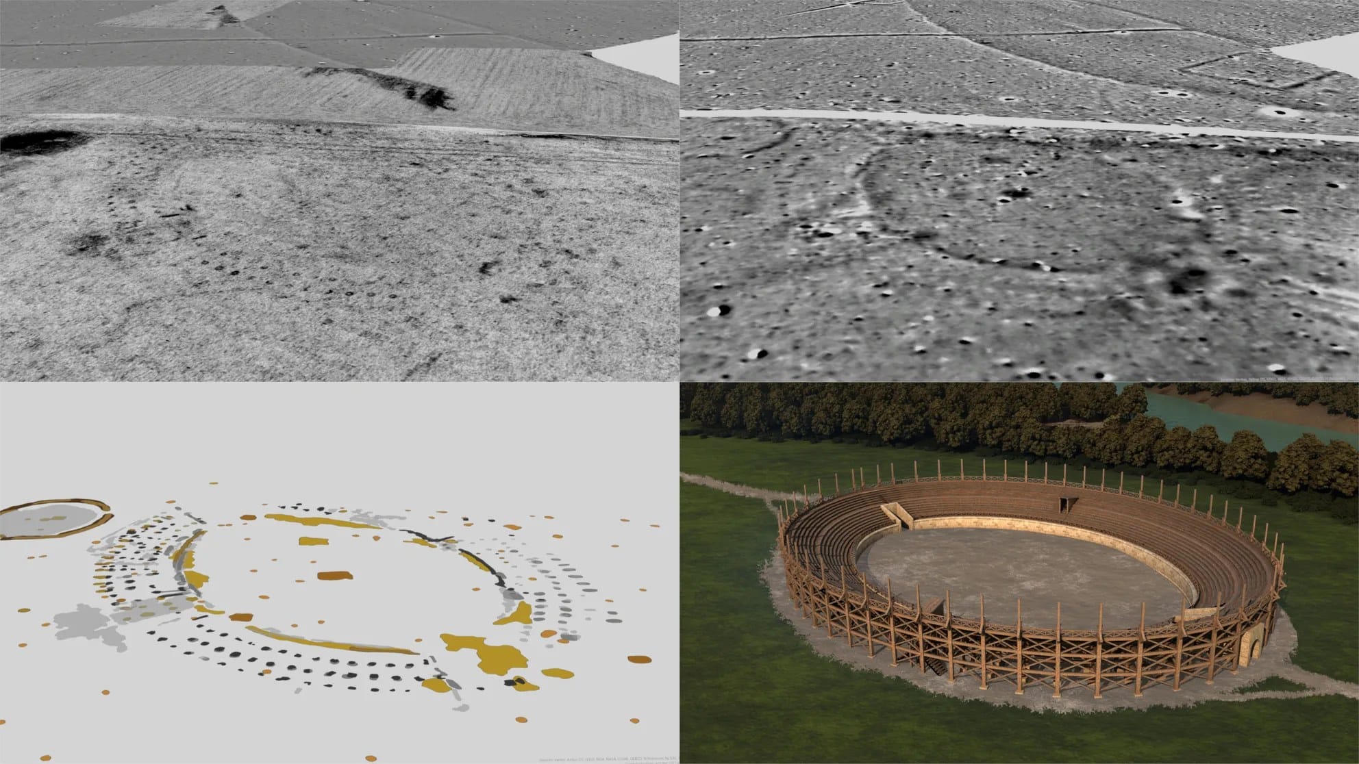
The scale is striking in the setting described by the researchers: an auxiliary fort associated with roughly 500 soldiers. The team’s assessment of the presently documented evidence allows them to say that a settlement of 25 to 30 hectares with a regular street grid beside a fort of this size has no known parallel in the Roman Empire.
An amphitheater indicates a substantial investment in public space, but the reports do not identify its programme, sponsors or spectators. Evidence from another city shows how varied arena culture could be: Pompeii’s painted notices for gladiator games advertised fighters and other attractions. Those notices provide context for Roman spectacles; they cannot tell us which events were staged at Stein, yet.
Why is the Danube Crossing Important
Stein lies on the Danube’s southern bank, opposite the area where the Aist enters from the north. The Innsbruck report says the fort was positioned to control a crossing there. The Aist valley provided a route toward the Vltava basin, connecting the frontier with movement and trade beyond Roman territory. The site thus occupied a river crossing as well as a place on the provincial edge.
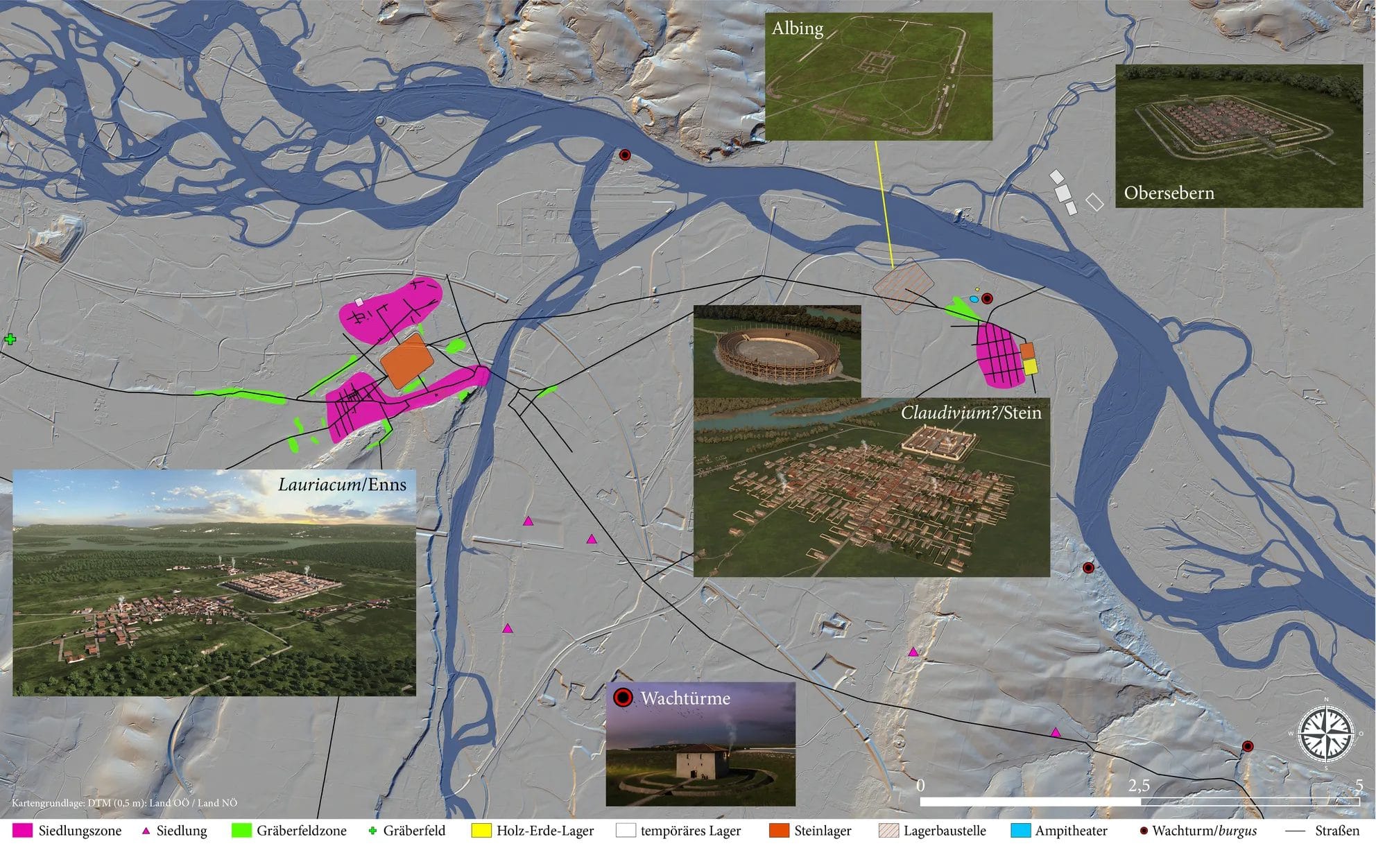
The fort and settlement were part of a larger landscape. The university reports temporary Roman camps north of the Danube and several watchtowers in the region. At nearby Albing, investigators also found foundation works for a planned legionary camp whose walls were never completed. These different sites should not be collapsed into one newly excavated city.
Roads led out from Stein toward other settlements and cemeteries. Along the outgoing routes, surveys identified burial grounds, including a large cemetery northwest of the town with graves, monuments and mounds. The researchers take the size of some memorials as a sign that wealthy people were buried there. Farther down the Danube, Trajan’s bridge and its adjoining roadworks offer a separate example of how crossings formed part of Roman military routes.
A Short Life and an Uneven Coin Record
The university places the start of occupation around AD 80 and its end around AD 180. The earlier archaeological study gives a more careful basis for that range. Its authors examined 643 Roman coins from different collections, alongside roughly 2,000 metal objects and 150 fragments of terra sigillata, the Roman fine ware. The coin sequence grows strongly from the Flavian period and then falls sharply after Marcus Aurelius.
Four coins belong to an issue of Commodus dated to April–August AD 180, while the next issue is absent from the studied group. The authors regard a withdrawal of troops and probably many residents around that time or shortly afterward as plausible. Some coins of later periods also reached the place, so the evidence supports an end to the dense occupation sequence rather than an absolute end to all visits.
The study warns that most finds came from fieldwalking or upper soil disturbed by cultivation, and only some coins have precise find locations. Early material from deeper layers may be underrepresented, making the founding date less secure than the apparent late-second-century change. The university reports no evidence of destruction and interprets the departure as planned. The contemporaneous change in Danube strategy under Commodus is a possible explanation, not a cause demonstrated by the coins alone.
Claudivium Remains a Question
Ptolemy recorded a place called Claudivium near the Danube. Researchers note that his coordinates could fit the site at Stein and that a river mentioned at the same coordinates could be the Aist. If that reading is correct, the name would provide a rare written counterpart to the buried settlement plan.
The 2024 study also explains why the identification is unresolved. The river in Ptolemy’s account has been identified differently, including with the Naarn, and other places have previously been proposed for Claudivium. The site’s ancient name cannot be read from its street plan or amphitheater. The question mark in the 2025 paper’s title, “Claudivium?”, reflects that uncertainty.
The same study cautions against assuming that the name implies a foundation under Emperor Claudius. Its present evidence instead points toward occupation beginning in the Flavian period, decades later. The absence of Claudivium from later route records could fit an early abandonment, but it is an argument for the proposal, not independent proof that the name belonged to Stein.
Excavation Can Test the Reconstruction
Targeted digging has already followed the broad surveys. A university photograph shows three excavated drying installations at the settlement’s southern edge; the researchers suggest they may have belonged to a brewery (that function remains an interpretation). Other university images show the survey equipment in the field, the amphitheater measurements and visualisations of the settlement landscape.
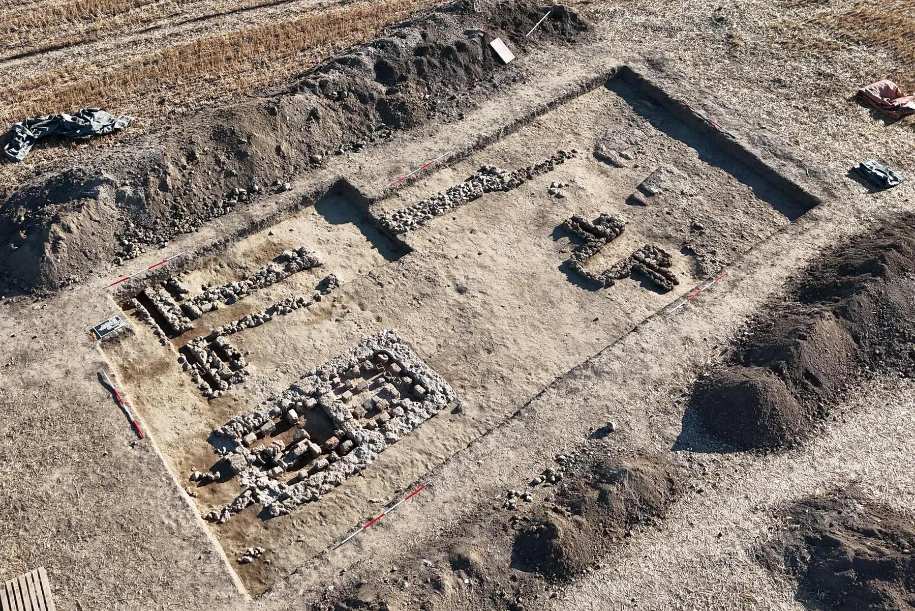
The need for further work extends beyond verifying Claudivium is the actual name of the settlement. Excavation could refine the sequence of streets and buildings, test the capacity estimate and clarify how the fort, town and burial grounds changed over time. Vienna.at reports concern that continued agriculture may gradually damage buried remains. The 2024 study independently documents that ploughing has already moved some artefacts into the upper soil, while also finding deeper archaeological layers still intact.
The university says a combination of aerial archaeology, geophysics, excavation and scientific analysis offers considerable potential, but longer-term funding has not yet been secured. For now, the mapped grid, amphitheater and coin sequence provide a substantial outline of Roman activity at Stein. The town’s formal status, exact name and the reasons for its departure, still remain as research questions.
University of Innsbruck, “Die vergessene Stadt: Roms Netzwerk beiderseits der Enns,” 25 September 2026
Mario Wallner et al., “Claudivium? – How to discover a new Roman town?,” ArcheoSciences 49-1 (2025), 219–222
Gerald Grabherr and Barbara Kainrath, “Das hippodamische Strassensystem im Lagerdorf des Auxiliarkastells in Stein/St. Pantaleon-Erla,” in Roman Urban Landscape (2024), 317–326
Vienna.at, “2,000 Years Hidden: Researchers Discover Roman City in Lower Austria,” 24 September 2026



About the Roman Empire Times
See all the latest news for the Roman Empire, ancient Roman historical facts, anecdotes from Roman Times and stories from the Empire at romanempiretimes.com. Contact our newsroom to report an update or send your story, photos and videos. Follow RET on Google News, Flipboard and subscribe here to our daily email.
Follow the Roman Empire Times on social media: