All roads lead to Rome. How did Romans build their roads?
Romans were building their roads so perfectly that they have survived 2000 years without maintenance.


The Roman road network began to expand alongside the Romans' territorial growth in the 4th century BCE. The primary motivation for constructing these paved suburban roads was military: to facilitate the rapid deployment of troops to the empire's unstable borders.
Additionally, the Romans built roads to connect various settlements and cities, enhancing communication and trade across the empire.
“All roads lead to Rome”
The phrase "omnes viae Romam ducunt" (all roads lead to Rome) originated in 20 BCE when Emperor Augustus placed a large golden spike next to the Temple of Saturn in the Forum Romanum. This spike, known as the Milliarium Aureum or Golden Milestone, served as the reference point from which distances to various cities across the empire were measured. It signified the starting point for Rome's extensive and well-engineered road network.
At its peak, the cursus publicus (public road network) comprised at least 380 interconnected roads, spanning approximately 80,000 kilometers. This vast network extended from northern Britain to the Persian Gulf, uniting the empire and facilitating trade and governance.
Roman roads were initially designed to facilitate the more efficient movement of armies, which primarily consisted of legions of foot soldiers. These troops would march from Rome to expand the empire's territories. The strategically planned and well-constructed roads allowed these armies to move with minimal hindrance, enhancing Rome's effectiveness in its conquests.
As the empire grew, these roads enabled armies to travel from one end of the empire to the other, safeguarding the empire from external threats. Once built to connect cities, Roman roads significantly facilitated general travel and the movement of goods, becoming a great advantage for both.
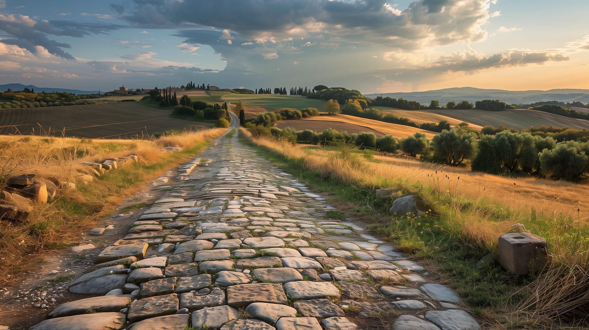
The earliest strategic consular Roman road was the Via Appia (the Appian Way), named after the Roman censor Appius Claudius Caecus. Constructed in 312 BCE, it extended southeast from Rome to Capua (near Naples) to ensure fresh troops could be sent quickly for the war against the Samnites. The road was built using a series of straight segments, considered the most efficient way to move troops and supplies. Over time, the Appian Way, often referred to as the regina viarum, was extended to reach Beneventum, Tarentum, and finally Brundisium on the Adriatic coast.
How were the Roman roads built?
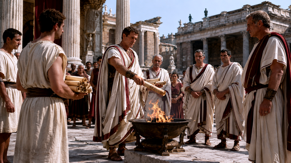
In order for the roads to be built, a class of skilled professionals was needed. These were the Roman land surveyors. They were known as "mensōrēs" or "agrimensores", with the term "gromatici" being a later designation derived from the "grōma", their principal surveying instrument. The primary task of these surveyors was to establish "limites" – roadways or boundary markers intersecting at right angles, dividing the land into squares or rectangles.
Initially, the surveyor would plot two fundamental "limites", and then additional "limites" would be established parallel to these, creating a systematic layout. Roman engineers constructed their roads to be as straight as possible, regardless of the terrain's obstacles. They preferred to go directly through hills rather than detouring around or over them, ensuring that travel was as convenient and short as possible for both foot traffic and horse-drawn wagons and carriages.
This approach also symbolized Roman dominion, as they imposed their will on nature itself. Roman engineers would go to great lengths, such as tunnelling through mountains, cutting passages through hills, or shearing off mountain spurs, to maintain the road's straightness. When the Romans began constructing a road, they often couldn't see the endpoint they were heading towards. Despite this, they managed to plot a straight route between the two points.
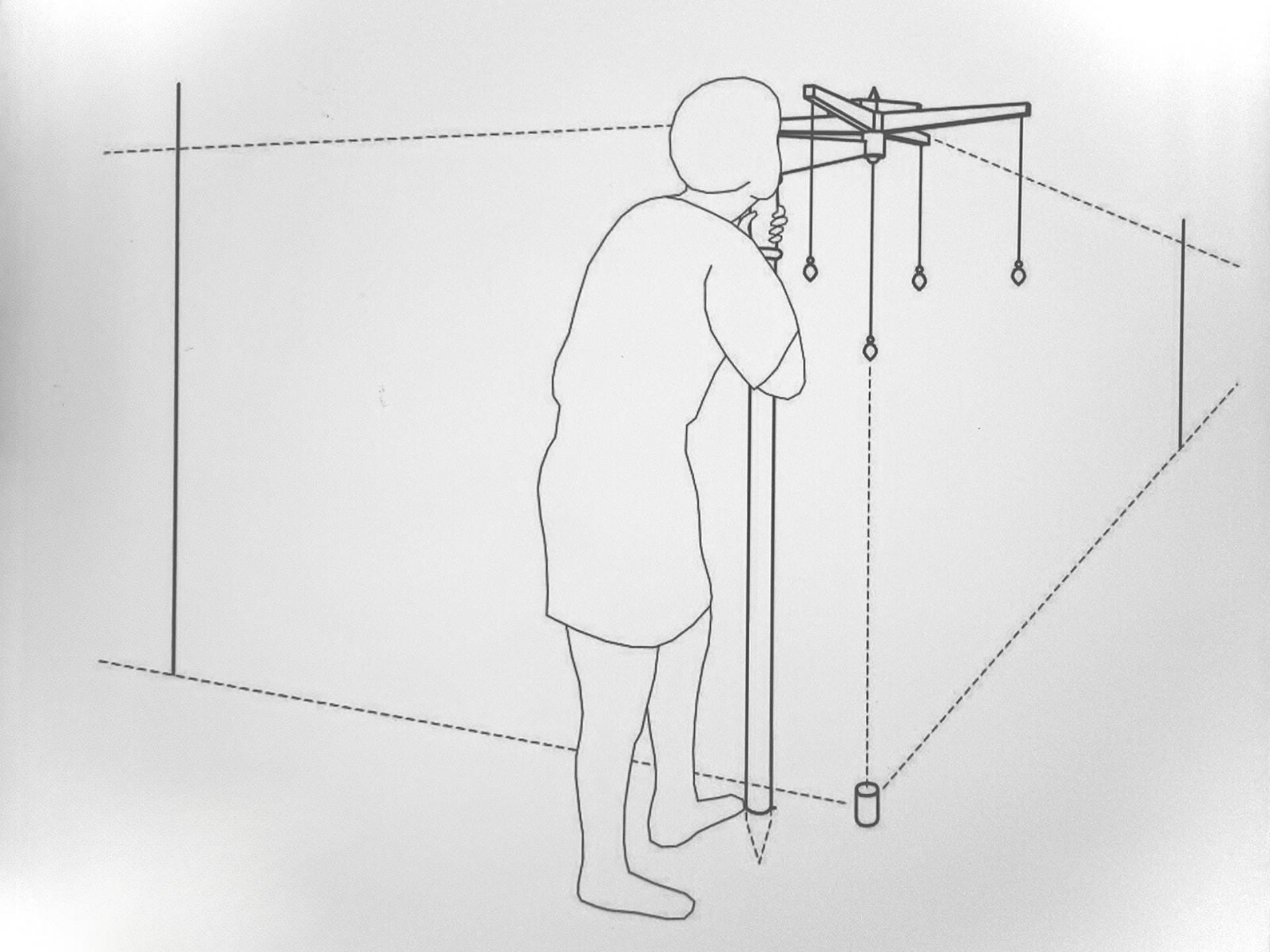
They achieved this by using a combination of beacons and a surveying instrument known as a "groma"
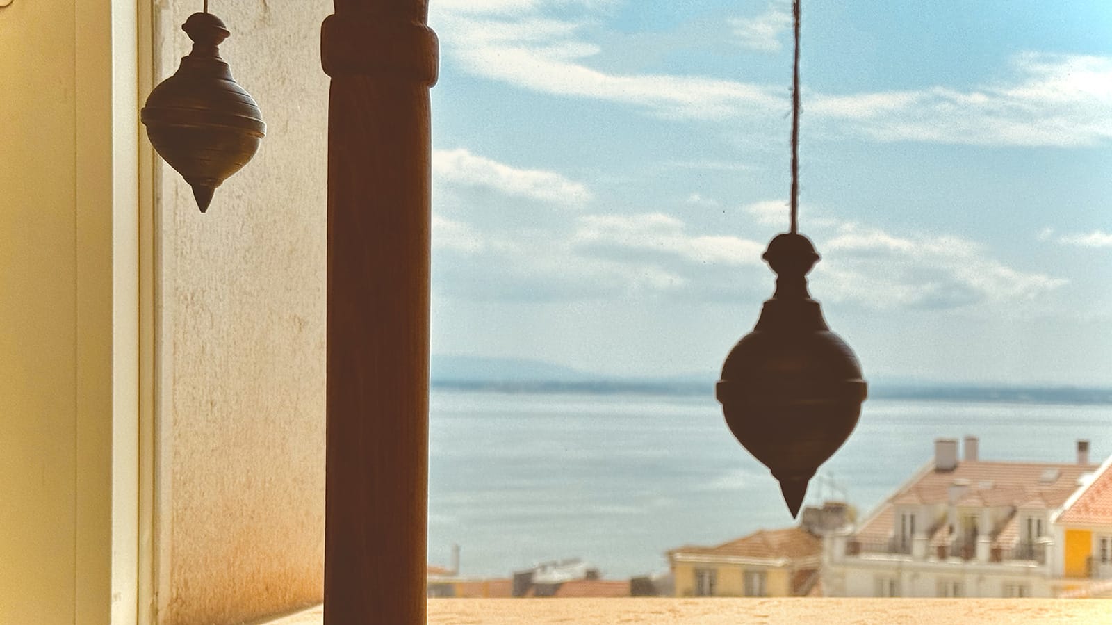
A representation of a groma’s use, in the Roman Theatre Museum in Lisbon. Photo credits: George Liapis
There was no standardized structure for Roman roads, although engineers aimed for consistency where possible; each road or section had to be adapted to unique conditions as needed. Generally, the first step was route selection. This involved meticulous topographic and geologic analysis of the land to determine not only the shortest distance between two points but also the necessary ancillary structures for the road's feasibility.
Surveying the entire route required considerable technical skill, particularly in creating long, straight stretches where the two ends were not visible to each other without the aid of a magnetic compass. Careful planning and adaptability were crucial for the successful construction of Roman roads.
The method of building a Roman road
Step 1: The use of beacons
Standing in Londinium, the Roman surveyor knew the approximate direction of Noviomagus, the city he intended to connect with a road. However, the direct line of sight to Noviomagus was obstructed by intervening hills.
To address this, the surveyor would light a beacon in Londinium and proceed towards Noviomagus. Upon reaching the highest visible point where the Londinium beacon was still observable, he would place a new beacon. Continuing in the general direction of Noviomagus, he would place subsequent beacons on elevated points, ensuring each new beacon was visible from the preceding one. This process would continue until Noviomagus came into view, where the final beacon was placed in the town.
This method resulted in a series of beacons connecting Londinium and Noviomagus, though not in a straight line. Aligning these beacons into a straight path involved the use of the groma, the surveying instrument we aforementioned.
Step 2: The use of groma
Believed to have beed originated in Egypt, this instrument comprised a long wooden staff with a pointed lower end and a wooden cross arm about 25cm (10 inches) long at the top. The cross arm had a pivot supporting the stellata, which was the main component and featured a wooden cross with plumb bobs at each end.
To use the groma, the surveyor set it up where two roads would intersect at right angles, using the plumb bobs as guides to lay out a line of stakes or flags. By aligning these stakes with the naked eye, a straight line could be maintained as the road's course was plotted.
The Romans were knowledgeable in geometry, using Pythagoras' triangles to create right angles. They likely used the stars, astrolabes, and armillary spheres for rough plotting, while the groma ensured the road's course was perfectly straight and true.

Combining the beacons with the groma
The surveyor would place the groma at the last beacon before Noviomagus and align two of its plumb lines with the beacon in Noviomagus.
Walking around the groma without touching it, the surveyor would check if the other two plumb lines aligned with the previous beacon. If the previous beacon was out of alignment, it would be adjusted until it lined up correctly. This process was quicker with a person at each beacon, although communication over distances was limited. In forests, fires and smoke were used to help align the beacons. By doing this, the surveyor could align three beacons at a time: the one in Noviomagus, the one at his location, and the next one towards Londinium.
The surveyor would then move between the beacons, using the groma to align each one with the preceding and following beacons, adjusting them until all were in a straight line between Londinium and Noviomagus.
What were the materials used?
The roads constructed by the Romans were made from aggregates, which included various sizes of stones compacted to create a durable, stable, and long-lasting surface. These roads could withstand the heavy marching of hundreds of soldiers and carts loaded with supplies.
Additionally, the Romans introduced two significant road-building innovations to Britain: road camber and drainage. The roads were built with a slight convex curve, known as a camber, which prevents water from pooling on the surface and making it soggy. Instead, the water is channelled to the edge of the road. Alongside this, the Romans constructed drains to absorb the runoff from the cambered roads and direct it away. This combination ensured the roads remained dry and durable.
Dating back to around 450 BC, the Laws of the Twelve Tables governed ancient Romans. These laws specified that roads should be 8 feet (2.45 meters) wide when straight and 16 feet (4.90 meters) wide when curved.
Roman law established the right to use a road as a "servitus," or claim. The "ius eundi" (right of going) allowed for the use of an "iter," meaning the right to walk or pass along. The "ius agendi" (right of driving) established an "actus," meaning the right to walk, pass, and drive cattle or light vehicles along a road.
The laws mandated that Romans build roads combining both types of easements and permitted travellers to pass over private land if the road was in disrepair. Consequently, constructing roads that required minimal repairs became an ideological goal. Additionally, building straight roads helped create the narrowest paths possible, minimizing the distance travelled and conserving materials. (via: https://mylearning.org)

Classification of Roman Roads
- Viae Publicae, Consulares, Praetoriae or Militares
Roads classified as Viae Publicae, Consulares, Praetoriae, or Militares were typically named after the censor who commissioned their construction or reconstruction. These roads were considered public high or main roads. They were built at the public's expense, and their land was owned by the state. Such roads led to the sea, a public river, a town, or another public road. They were overseen by curators (commissioners) and maintained by contractors (Redemptoris) at public expense, with a fixed contribution levied from neighbouring landowners. - Viae Privatae, Rusticae, Glareae or Agrariae
These roads fall into the second category, which includes private or country roads. Such roads were constructed by private individuals who owned the land and had the authority to dedicate them for public use. Under the classification of Viae Privatae, these roads often led to specific estates or settlements. The main roads were connected to secondary roads known as Viae Rusticae. Both main and secondary roads could be either paved or left unpaved with a gravel surface, the latter being referred to as Viae Glareae. Beyond these secondary roads were smaller, unpaved roads known as Viae Terrence or dirt roads. - Viae Vicinales
The last category of Roman roads includes those found in villages, districts, and crossroads leading through or toward a vicus (village). These roads were deemed either public or private based on the funding source used for their construction. The maintenance and repair of the Viae Vicinales were the responsibility of the Magistri Pagorum (magistrates of the pagus or canton). These officials could require neighbouring landowners to either provide labour or maintain a certain length of the road passing through their properties at their own expense. (via: https://engineeringrome.org/)


About the Roman Empire Times
See all the latest news for the Roman Empire, ancient Roman historical facts, anecdotes from Roman Times and stories from the Empire at romanempiretimes.com. Contact our newsroom to report an update or send your story, photos and videos. Follow RET on Google News, Flipboard and subscribe here to our daily email.
Follow the Roman Empire Times on social media: